
| Citation: |
ZHANG Maosheng, DONG Ying, SUN Pingping, LIU Jiang, WANG Huaqi, FENG Li. 2023. Theory and Method for Urban–Rural Integration, Evaluation and Cooperative Detection of Ground and Underground Space: Example from the Urban Geological Survey of Guanzhong Plain. Northwestern Geology, 56(3): 153-168. doi: 10.12401/j.nwg.2023054

|
Theory and Method for Urban–Rural Integration, Evaluation and Cooperative Detection of Ground and Underground Space: Example from the Urban Geological Survey of Guanzhong Plain
-
Abstract
The collaborative detection and evaluation planning of ground and underground space is an important way to enhance the comprehensive carrying capacity of the city and promote the high–quality development of the city. In view of the new major scientific and technological problems such as "multi–plan integration" territorial spatial planning, coordinated and intensive utilization of ground and underground space aimed at the coordinated development of new urbanization and rural revitalization in China, taking Guanzhong plain urban agglomeration as the research area, based on the theories of the earth system science, the earth key belt, system, synergy and information, this paper puts forward the urban geological theory in the new period of urban–rural integration, coordinated detection, comprehensive evaluation and overall planning of ground and underground space; breaks through the key technologies of fine detection and modeling of underground space under the strong urban interference environment; proposes the risk prevention and control technology of ground and underground space based on groundwater; reveal the heat conduction law of geothermal fluid–exchanger in underground space, and raise the new green development technology of geothermal energy in underground space of "taking heat but not taking water". Which will provide the technique support for the urban planning, construction and operation management, land space planning, natural resource management, etc. And the theroies and the technologies have been successfully applied in many cities.
-
Keywords:
- urban geology /
- underground space /
- new urbanization /
- rural revitalization /
- Guanzhong plain
-

-
References
[1] 董英,刘洁,王化齐. 西北地区城市地质调查与城市规划建设[J]. 西北地质,2022,55(03):200–209. DONG Ying, LIU Jie, WANG Huaqi. Urban Geological Survey and Urban Planning and Construction in Northwest China[J]. Northwestern Geology, 2022, 55(03): 200-209. [2] 董英,张茂省,李宁,等. 城市地下空间开发利用的地质安全评价内容与方法[J]. 水文地质工程地质,2020,47(05):161–168. DONG Ying, ZHANG Maosheng, LI Ning, et al. . Methods and contents of geological safety evaluation for urbanunderground space development and utilization[J]. Hydrogeology & Engineering Geology, 2020, 47(05): 161-168. [3] 黄强兵,彭建兵,范文,等. 西安地铁二号线沿线地裂缝未来位错量估算及工程分级[J]. 工程地质学报,2007,15(04):469–474. HUANG Qiangbing, PENG Jianbing, FANwen, et al. Estimation of the maximum displacement of ground fissuresalong Xi'an metro line 2anditsengineeringclassification. Journal of Engineering Geology, 2007(04): 469-474. [4] 马琰,连皓,雷振东,等. 西咸城乡融合发展试验区融合发展路径与策略[J]. 规划师,2021,37(09):61–67. Ma Yan, Lian Hao, Lei Zhendong, et al. . Development Path and Strategy of Xi’an-Xianyang Urban-rural Integration Pilot Area[J]. Planners, 2021, 37(09): 61-67. [5] 彭建兵, 苏生瑞, 张骏. 渭河盆地活动断裂与地质灾害[M]. 西安: 西北大学出版社, 1992 [6] 彭建兵,范文,李喜安,等. 汾渭盆地地裂缝成因研究中的若干关键问题[J]. 工程地质学报,2007,(04):433–440. PENG Jianbing, FAN Wen, LI Xi'an, et al. Some Key Questionsin the Formation of Ground Fissuresin the Fen-Wei Basin[J]. Journal of Engineering Geology, 2007(04): 433-440. [7] 王亚辉,张茂省,师云超,等. 基于综合物探的城市地下空间探测与建模[J]. 西北地质,2019,52(02):83–94. WANG Yahui, ZHANG Maosheng, SHI Yunchao, et al. . Precise Detection and Modeling of Urban Underground Space Based onIntegrated Geophysical Exploration[J]. Northwestern Geology, 2019, 52(02): 83-94. [8] 张家明. 西安地裂缝研究[M]. 西安: 西北大学出版社, 1990, 68−88 [9] 张茂省, 董英, 刘江, 等. 关中平原城市地质[M]. 北京: 科学出版社, 2021 [10] 张茂省,董英,刘洁. 论新型城镇化中的城市地质工作[J]. 兰州大学学报(自然科学版),2014,50(05):581–587. ZHANG Maosheng, DONG Ying, LIU Jie. Discussion of urban geological work in new urbanlization[J]. Journal of Lanzhou University (Natural Sciences), 2014, 50(05): 581-587. [11] 张茂省,董英,张新社,等. 地面沉降预测及其风险防控对策—以大西安西咸新区为例[J]. 中国地质灾害与防治学报,2013,24(04):115–118+126. ZHANG Maosheng, DONG Ying, ZHANG Xinshe, et al. Prediction of land subsidence and Its mitigation methods-a case studyin the new urban district of Xi'an-Xianyang. The Chinese Journal of Geological Hazard and Control, 2013, 24(04): 115-118+126. [12] 张茂省,王化齐,王尧,等. 中国城市地质调查进展与展望[J]. 西北地质,2018,51(04):1–9. ZHANG Maosheng, WANG Huaqi, DONG Ying, et al. . Progress and Prospect of Urban Geological Survey in China[J]. Northwestern Geology, 2018, 51(04): 1-9. -
Access History
Figures(21)

Export File
Citation
ZHANG Maosheng, DONG Ying, SUN Pingping, LIU Jiang, WANG Huaqi, FENG Li. 2023. Theory and Method for Urban–Rural Integration, Evaluation and Cooperative Detection of Ground and Underground Space: Example from the Urban Geological Survey of Guanzhong Plain. Northwestern Geology, 56(3): 153-168. doi: 10.12401/j.nwg.2023054
Format
Content
 DownLoad:


-
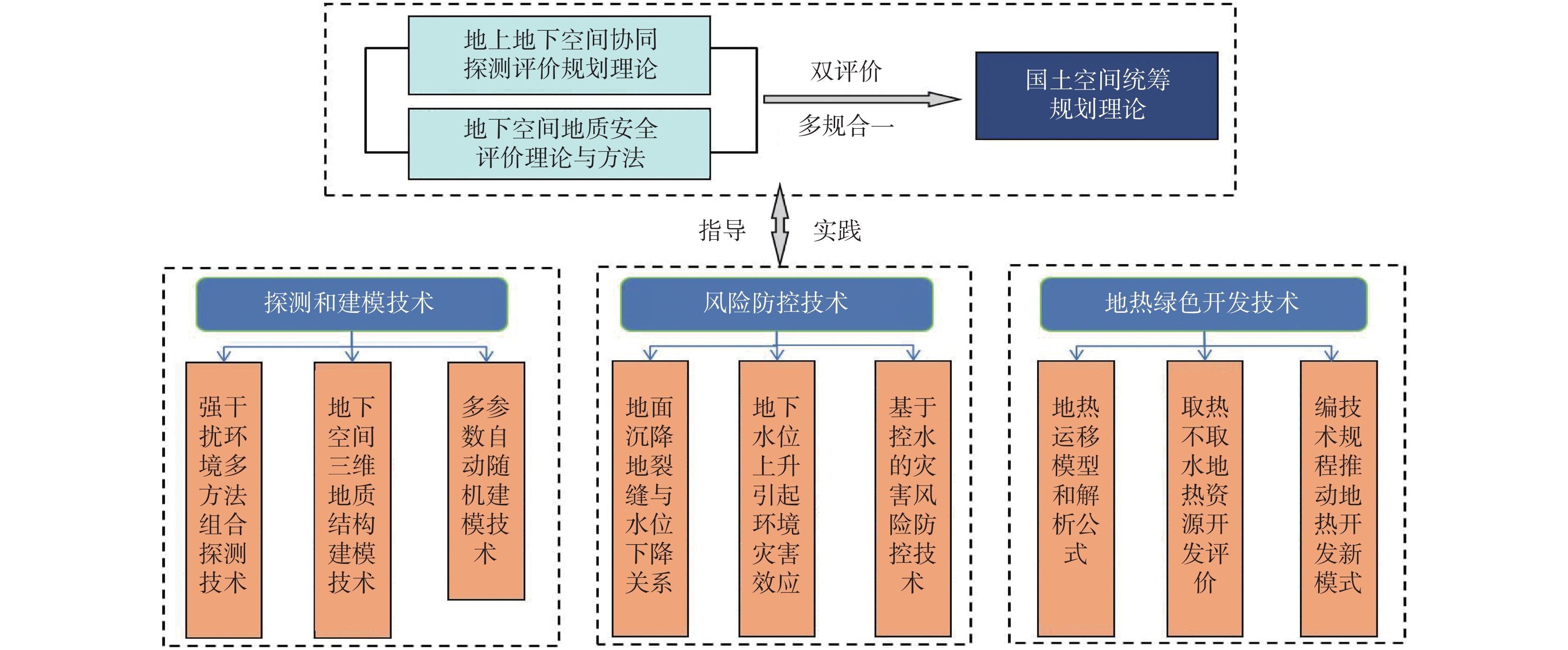
Figure 1.
The route map of technology
-
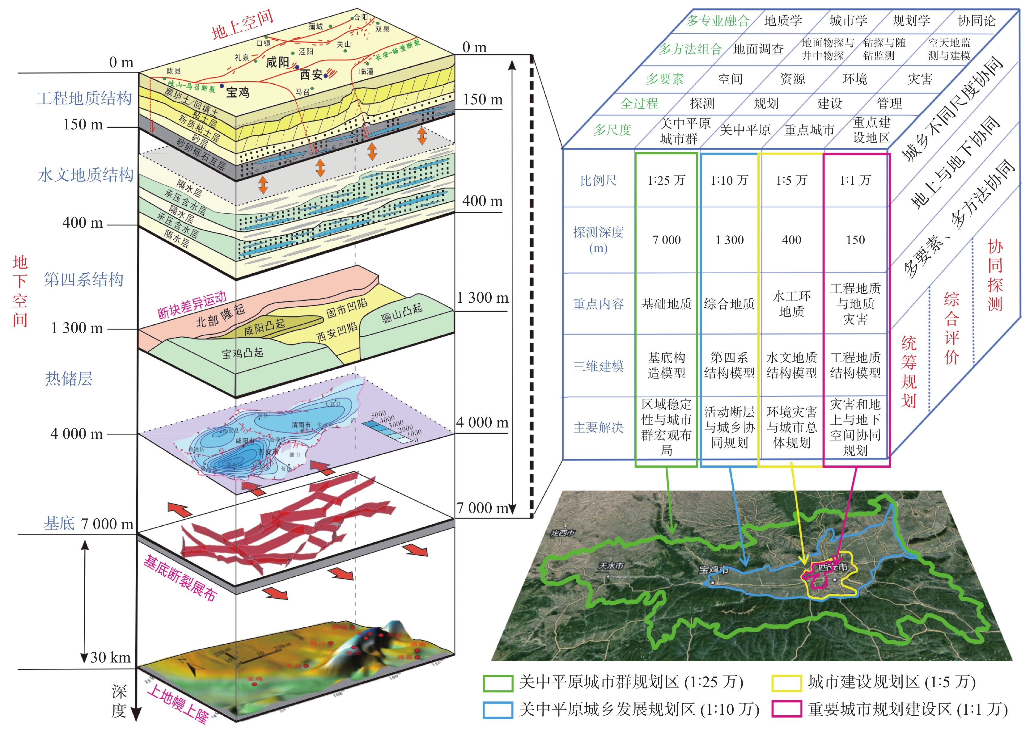
Figure 2.
The frame map for cooperative detection, evaluation and planning theory of ground and underground space
-
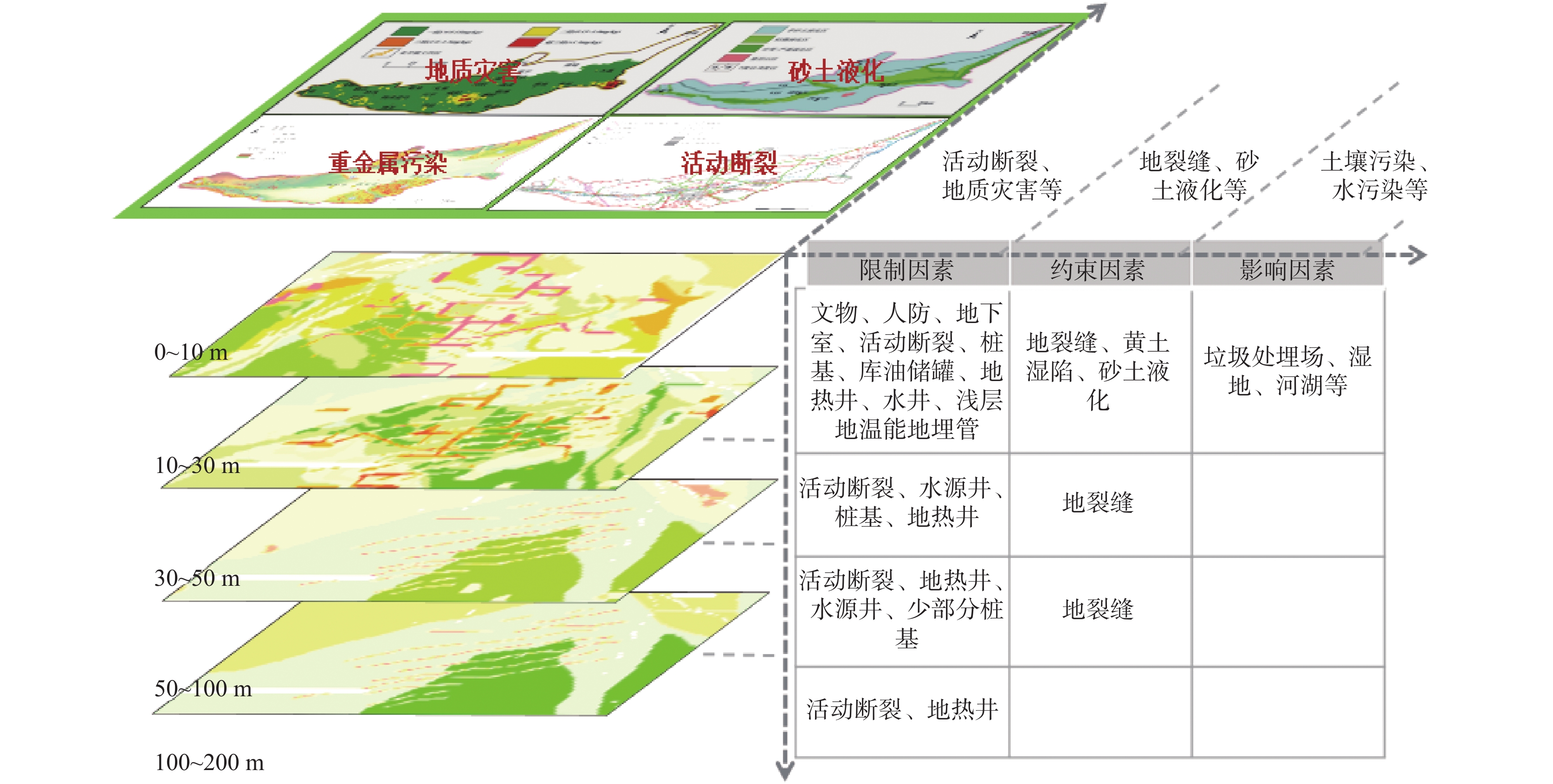
Figure 3.
Integrated evaluation map of ground and underground space based on negative factors
-
Figure 4.
(a~d) The overall planning theory and (e~f) results map for territory space based on barrel theory, margin and risk analysis
-
Figure 5.
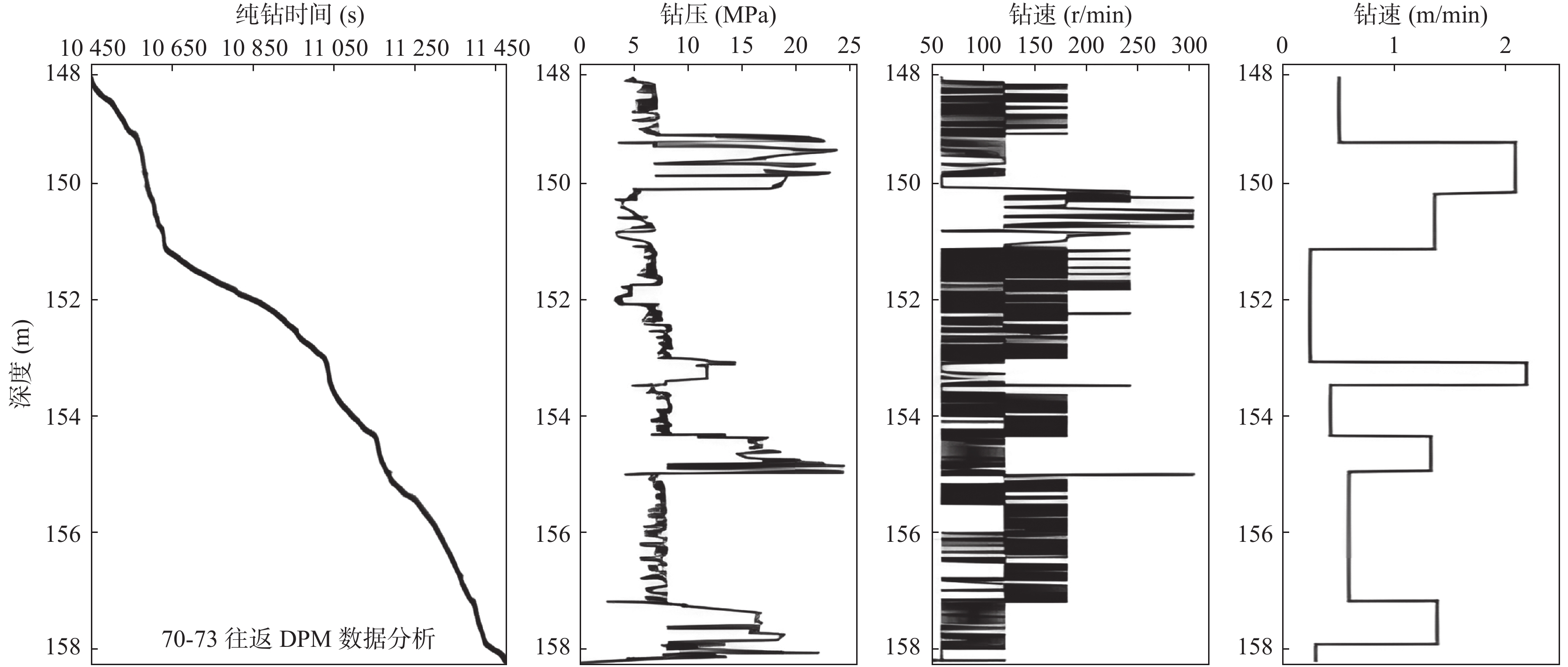
The figure for the changof the monitoring data with the depth while drilling
-
Figure 6.
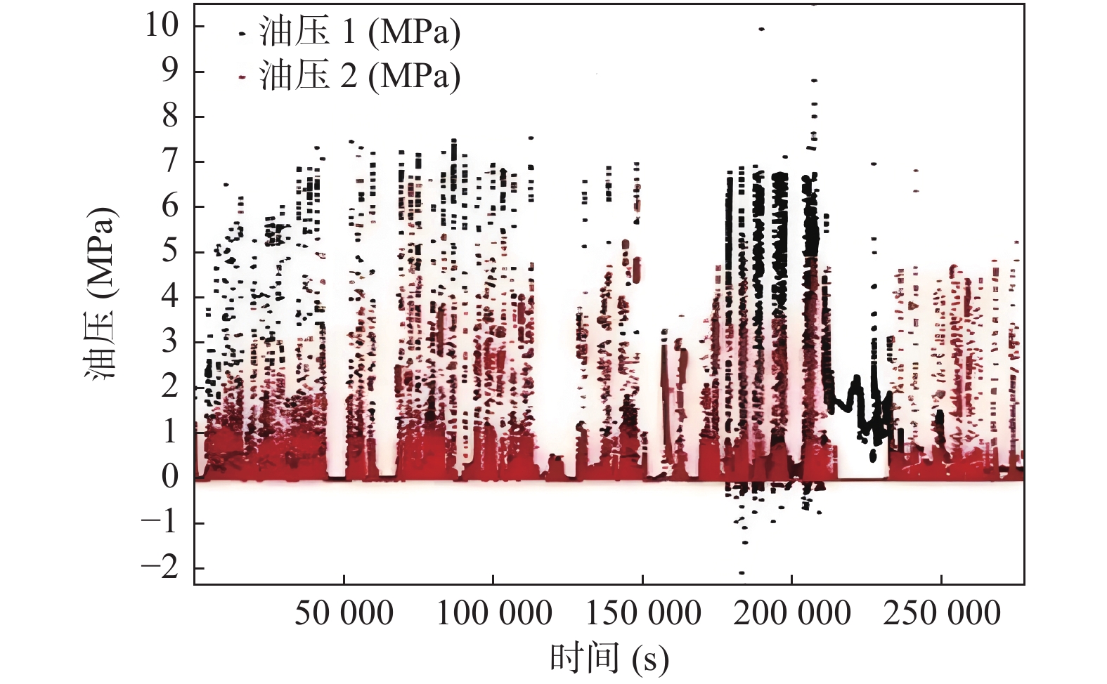
The relationship figure of the origional oil pressure and time
-
Figure 7.
The figure of the comprehensive detection well parameters and interpretation
-
Figure 8.
The Structure of urban geological database of Guanzhong plain
-
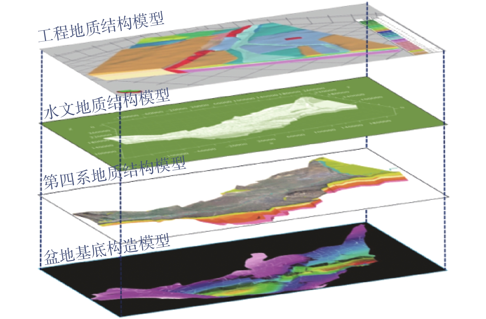
Figure 9.
Geological structure modeling map based on block of Guanzhong plain
-
Figure 10.
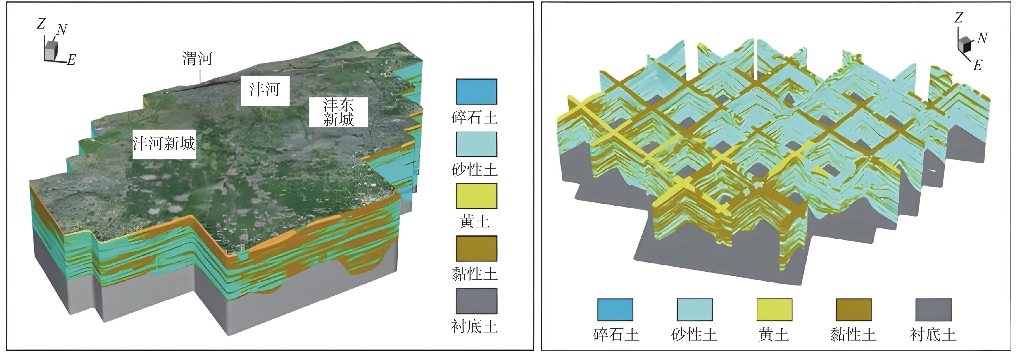
Lithology random model and profile fence map in Xixian New Area
-
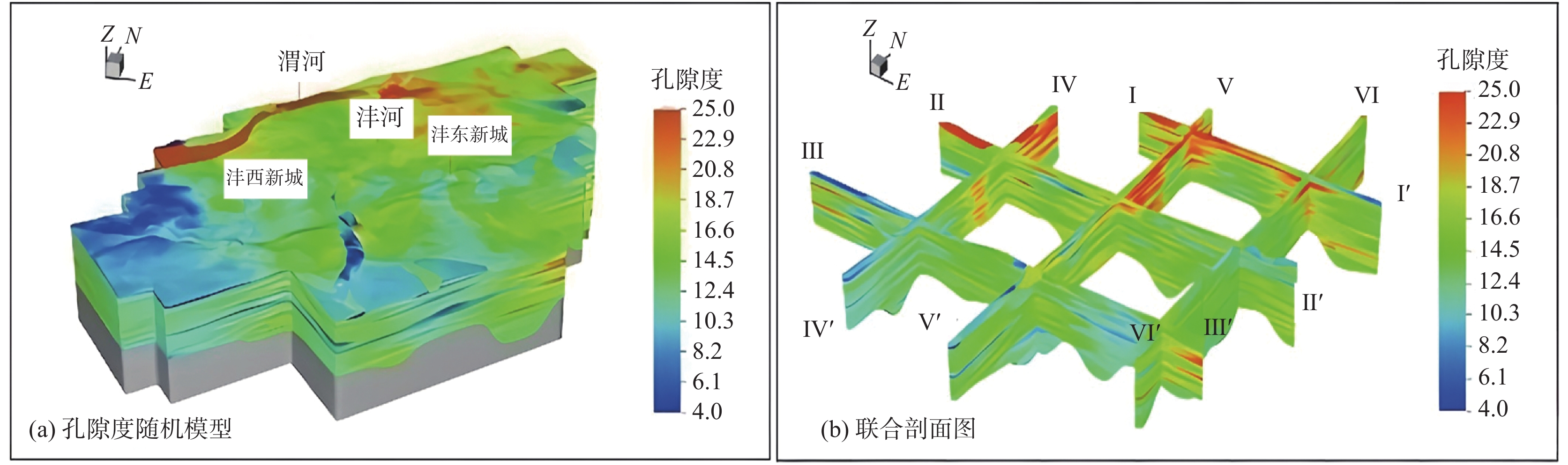
Figure 11.
The porosity random model and profile fence map in Xixian New Area
-
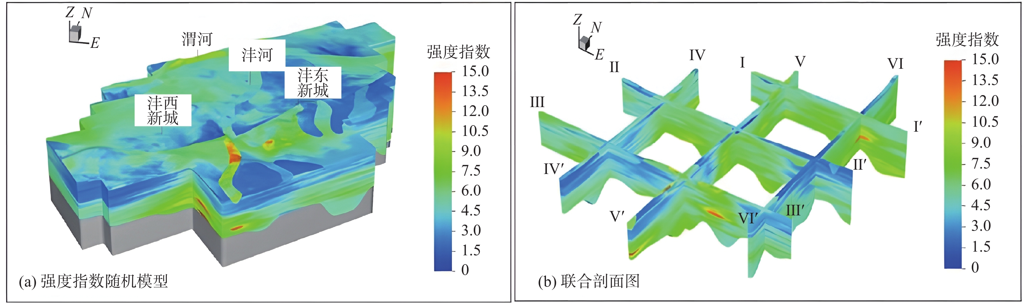
Figure 12.
The strength index random model and profile fence map in Xixian New Area
-
Figure 13.
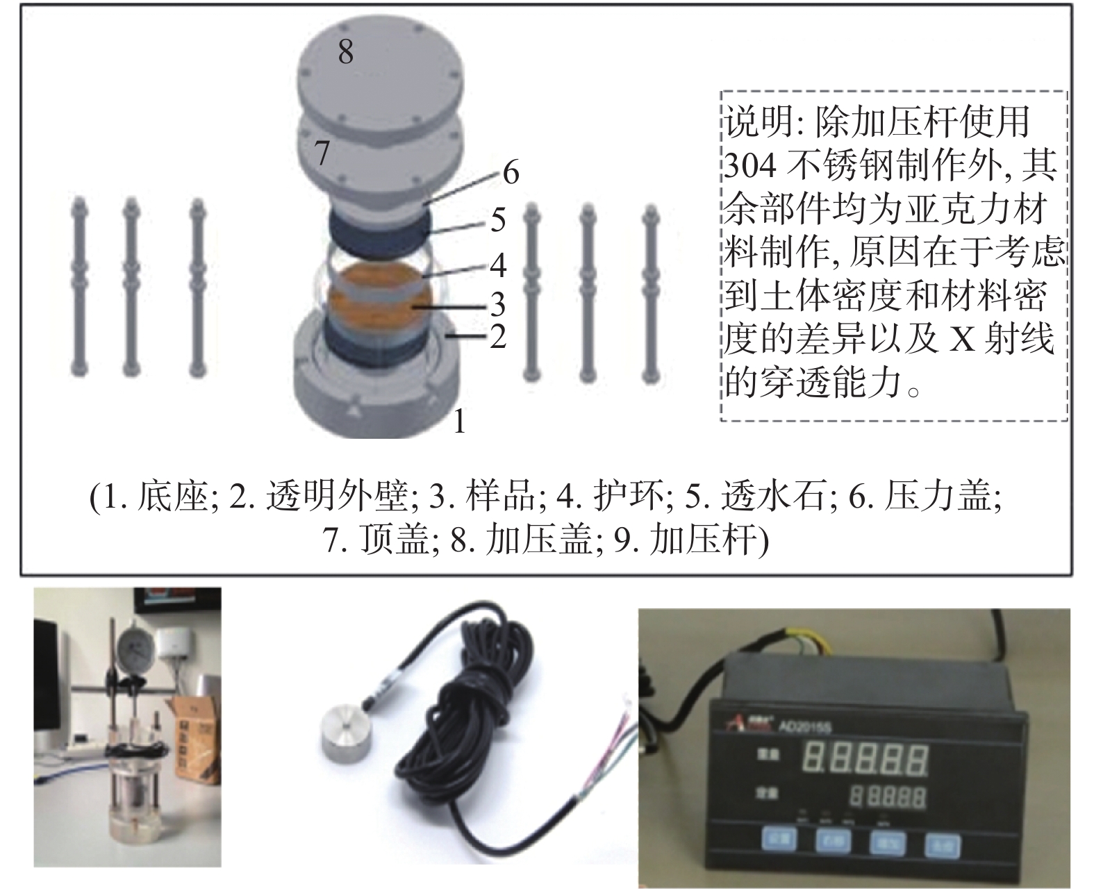
The cohesive soil compaction test instrument
-
Figure 14.
The pore images of cohesive soil at different depths under different formation pressures obtained by industrial CT
-
Figure 15.
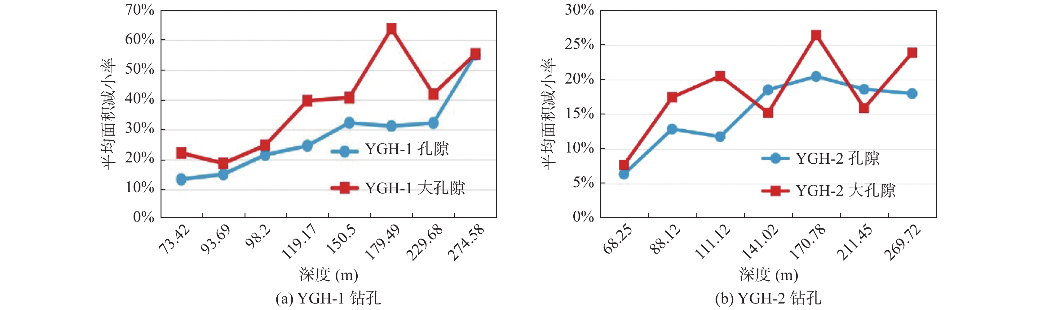
The comparison of the reduction rate compression deformation between large pore and void area of cohesive soil
-
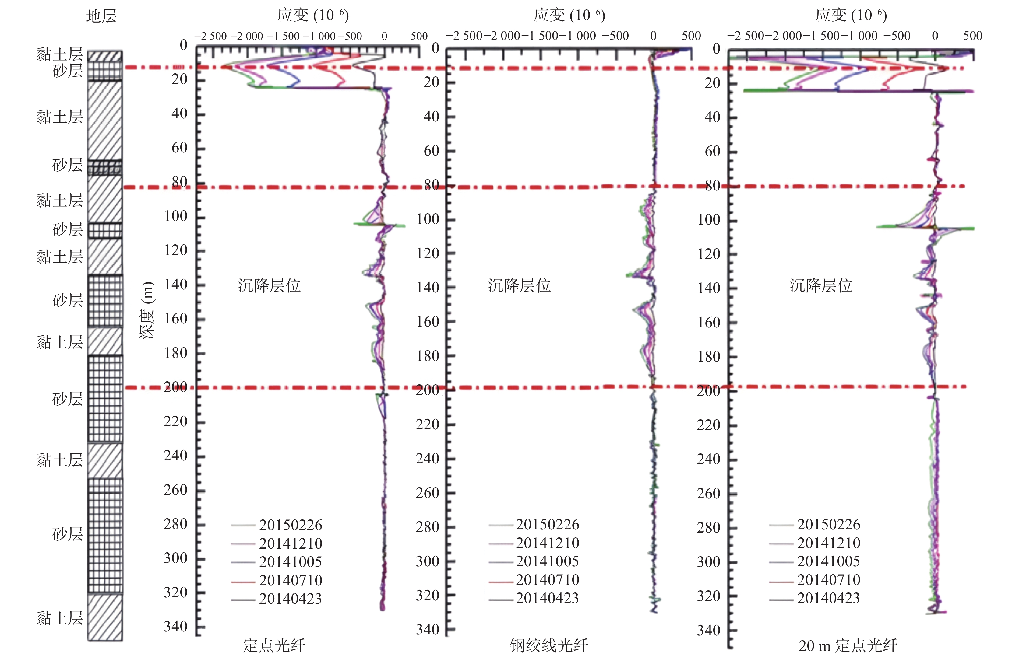
Figure 16.
The distributed fiber monitoring curve of the ground subsidence
-
Figure 17.
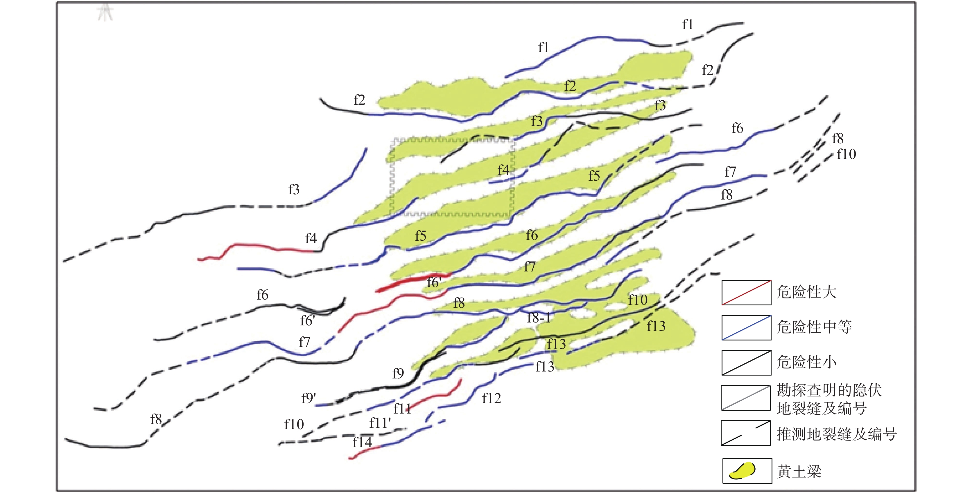
The risk sssessment map of ground fissures in Xi’an Area
-
Figure 18.
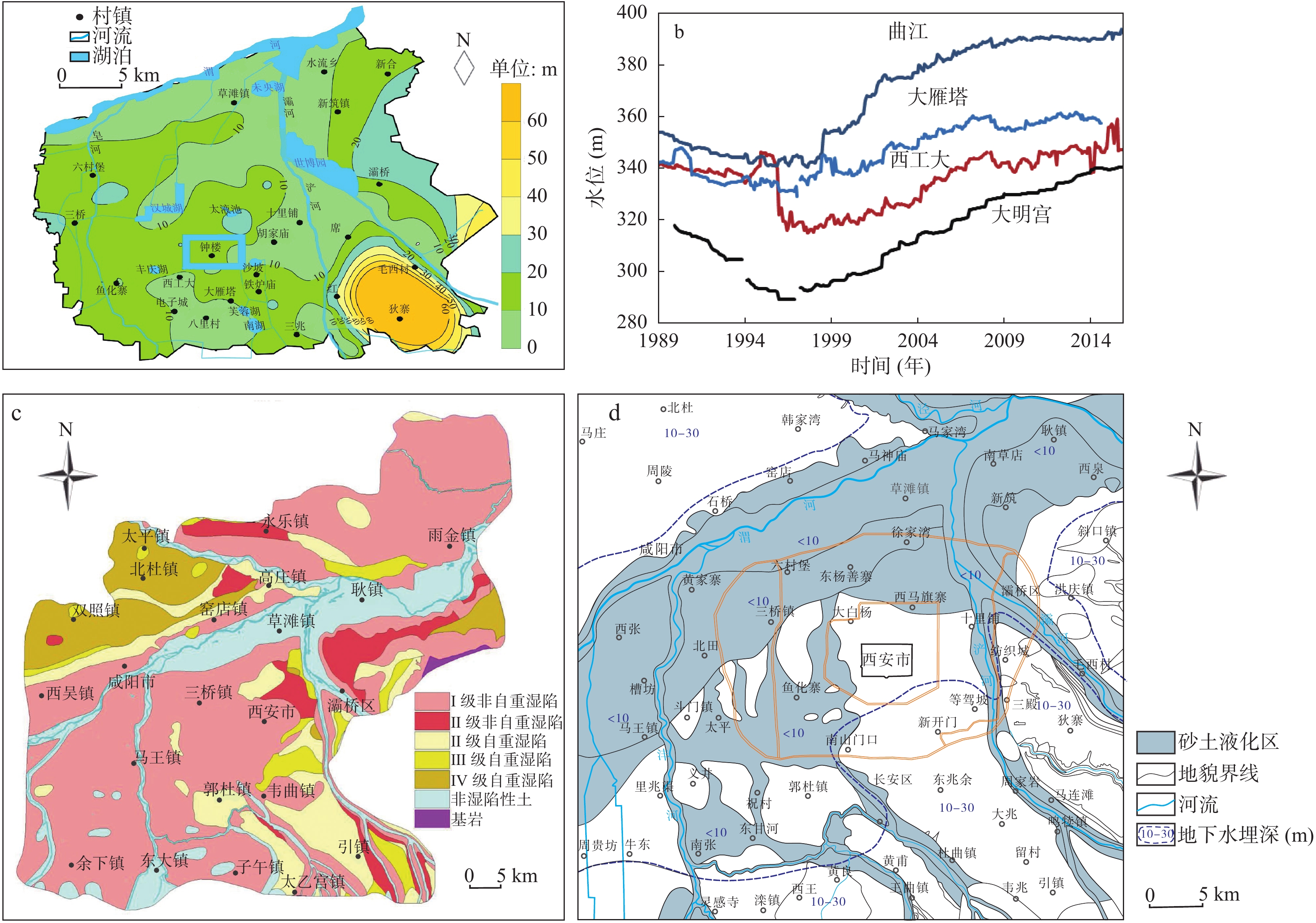
(a) The depth and (b) change of groundwater table, and the related evaluation maps of (c) loess collapsibility and (d) sand liquefaction
-
Figure 19.
The comparison figure of ground subsidence caused by pumping and ground rebound uplift caused by sudden shut–in
-
Figure 20.
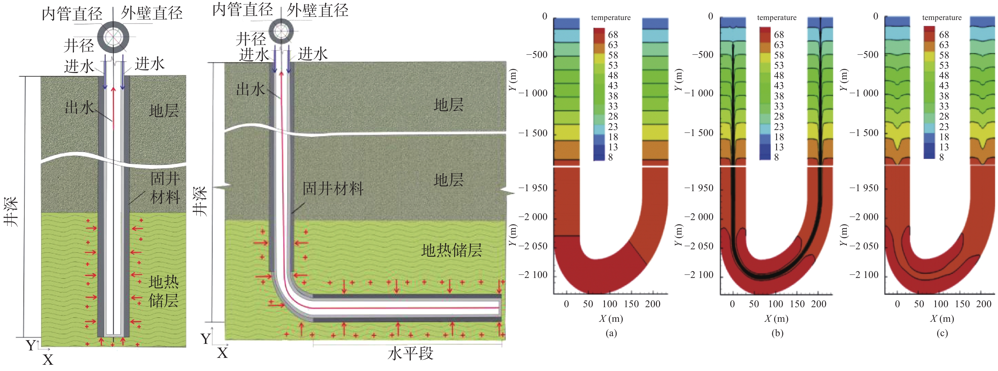
The geothermal well type and numerical simulation of heat migration of "take heat without water"
-
Figure 21.
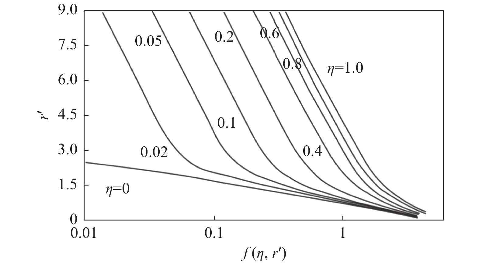
The relationship figure of r´ and f in the different value of η