
| China Geological Survey Chinese Academy of Geological Sciences | Host |
| 科学出版社 | Publish |

| Citation: |
LYU Lin, LI Wei, LIU Yuanqing, WANG Xinfeng, MA Xuemei, DENG Qijun. 2018. Dataset of the 1: 50 000 Hydrogeological Map of Laiwu City, Shandong Province[J]. Geology in China, 45(S2): 39-46. doi: 10.12029/gc2018Z205

|
Dataset of the 1: 50 000 Hydrogeological Map of Laiwu City, Shandong Province
-
Abstract
This dataset is prepared based on the latest data obtained from a new round of hydrogeological survey with the 1:50 000 Spatial Database of Topographical Map and some data of 1:50 000 Geological Map of Laiwu City, Shandong Province, as the base map. In addition to the hydrogeological map, the dataset includes data sheets on pumping (domestic) wells, springs, boreholes, water quality analysis and calculation of water volume including 209 pumping (domestic) wells, 14 springs, 13 reservoirs, 13 long-run monitoring points (936 point-times monitoring data), 100 point-times of simultaneous-measurement of groundwater level and groundwater volume, 6 environmental geological points, and 90 sets of samples acquired (total analysis, isotope and rock). For this dataset, the platform MapGIS 6.7 is used to prepare maps, the data size is about 169 MB, and the national geodetic coordinate system CGCS 2000 and Gauss-Kruger Projection (6-degree belt) are adopted. Furthermore, not only is 2D method used to mark critical hydrogeological information in the dataset, 3D method is introduced in the master map and part mosaic maps to express relief.
-
Keywords:
- hydrogeological /
- dataset /
- 1:50 000 /
- Laiwu City
-

-
References
陈梦熊. 1964.综合水文地质图编图原则的探讨[J].地质论评, 22(3):224-232 doi: 10.3321/j.issn:0371-5736.1964.03.008 陈梦熊, 熊淑琴. 1984.我国水文地质编图工作的发展与成就[J].中国地质(10):19-23 陈梦熊. 1988.我国岩溶地区水文地质图编图经验[J].中国岩溶, 7(3):199-204 陈梦熊. 2001.地下水资源图编图方法指南[M].北京:地质出版社. 郝爱兵, 张二勇, 王璜. 2017.三位一体推进水文地质调查科技创新[J].水文地质工程地质, 44(5):3 刘春蓁, 刘志雨, 谢正辉. 2007.地下水对气候变化的敏感性研究进展[J].水文, 27(2):1-6 刘焕贵, 赖华福. 2017.江西省崇义聂都瓦窑坑白钨矿区资源储量数据集[J].中国地质, 44(S1):96-104 庞健峰, 丁孝忠, 韩坤英, 曾勇, 陈安蜀, 张艳玲, 张庆和, 姚东升. 2017.1:100万中华人民共和国数字地质图空间数据库[J].中国地质, 44(S1):8-18 吴爱民, Giovanni Conte, LucioMartarelli, 马荣. 2016.意大利水文地质调查编图指南解读及其借鉴意义[J].水文地质工程地质, 43(5):166-171 Chen Mengxiong. 1964. Discussion on the Principles of Comprehensive Hydrogeological Maps[J]. Geological Review, 22(3):224-232 (in Chinese) Chen Mengxiong, Xiong Shuqin. 1984. Development and Achievements of Hydrogeological Mapping in China[J]. Geology in China, (10):19-23 (in Chinese) Chen Mengxiong. 1988. Experience in Mapping Hydrogeological Maps in Karst Areas of China[J]. Chinese karst, 7(3):199-204 (in Chinese) Chen Mengxiong. 2001. Guidelines for Mapping Groundwater Resources Maps[M]. Beijing:Geological Publishing House (in Chinese). Hao Aibin, Zhang Eryong, Wang Huang. 2017. Trinity promotes scientific and technological innovation in hydrogeological survey[J]. Hydrogeological Engineering Geology, 44(5):3(in Chinese) Liu Chunzhen, Liu Zhiyu, Xie Zhenghui. 2007. Recent Advances in Research on Sensitivity of Groundwater to Climate Changes[J]. Journal of China Hydrology, 27(2):1-6 (in Chinese with English abstract) Liu Huangui, Lai Huafu. 2017. The resource reserves dataset of the Wayaokeng scheelite mining area, Niedu, Chongyi, Jiangxi Province[J]. Geology in China, 44(S1):118-127 Pang Jianfeng, Ding Xiaozhong, Han Kunying, Zeng Yong, Chen Anshu, Zhang Yanling, Zhang Qinghe, Yao Dongsheng. 2017. The national 1:1 000 000 geological map spatial database[J]. Geology in China, 44(S1):10-23 Wu Aimin, Giovanni Conte, Lucio Martarelli, Ma Rong. 2017. Understanding and Discussions on Hydrogeological Map of Italy-Guidelines to Survey and Mapping[J]. Hydrogeology & Engineering Geology, 43(5):166-172 (in Chinese with English abstract) -
Access History
Figures(4)
Tables(4)

Export File
Citation
LYU Lin, LI Wei, LIU Yuanqing, WANG Xinfeng, MA Xuemei, DENG Qijun. 2018. Dataset of the 1: 50 000 Hydrogeological Map of Laiwu City, Shandong Province[J]. Geology in China, 45(S2): 39-46. doi: 10.12029/gc2018Z205
Format
Content
 DownLoad:


- Figure 1.
- Figure 2.
-
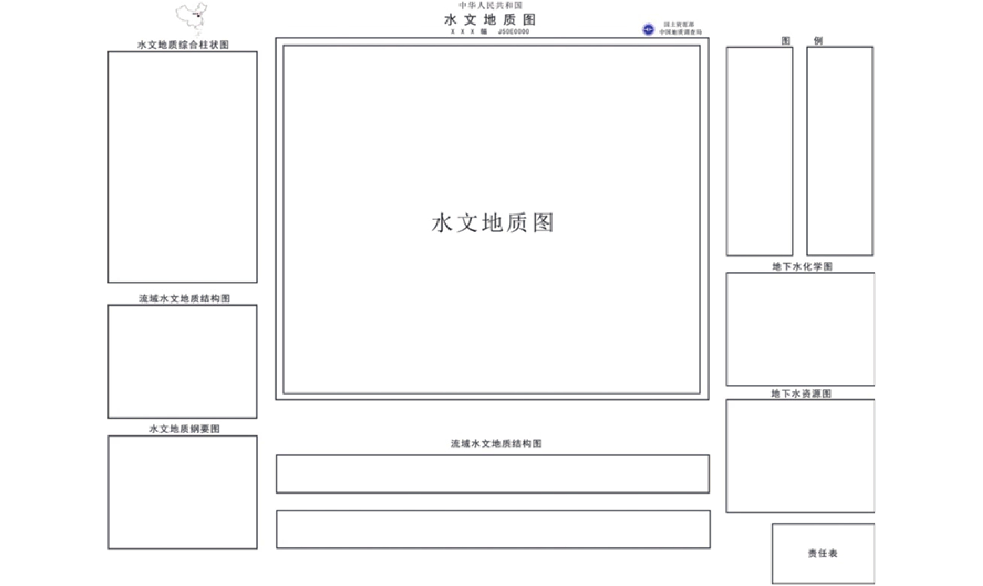
Figure 1.
Schematic Diagram of Hydrogeological Map Structure
-
Figure 2.
1:50 000 Hydrogeological Map of Laiwu City