
| Institute of Hydrogeology and Environmental Geology, Chinese Academy of Geological Sciences | Host |
| Groundwater Science and Engineering Limited | Publish |
| Citation: |
Muthamilselvan A. 2021. Identification of suitable sites for open and bore well using ground magnetic survey. Journal of Groundwater Science and Engineering, 9(3): 256-268. doi: 10.19637/j.cnki.2305-7068.2021.03.008

|
Identification of suitable sites for open and bore well using ground magnetic survey
-
Abstract
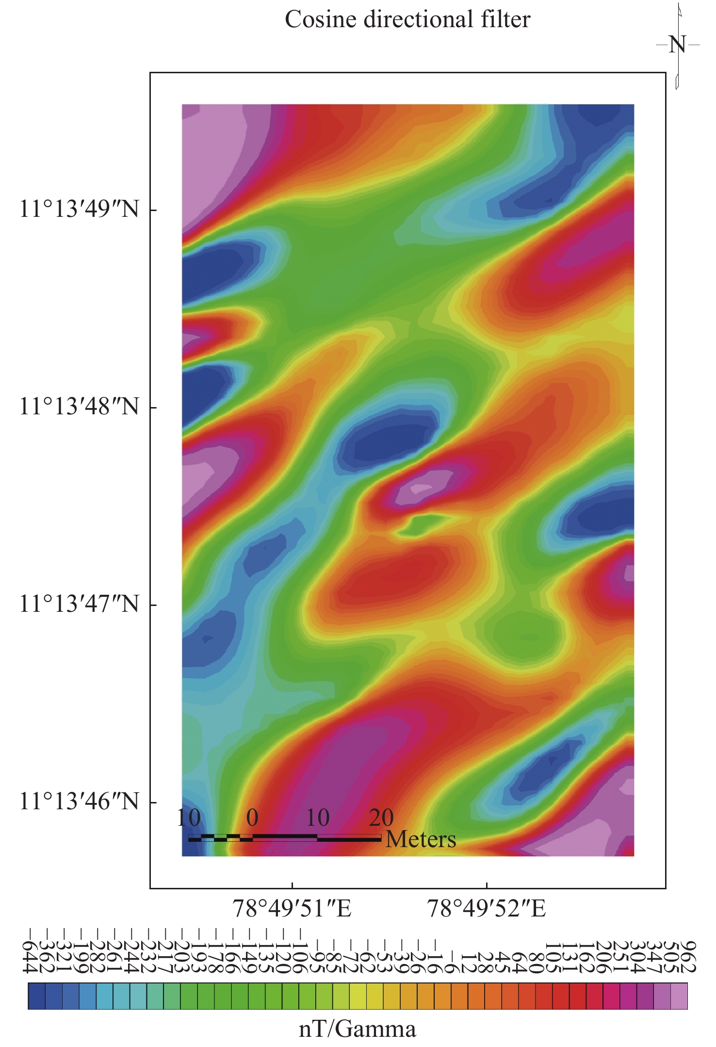
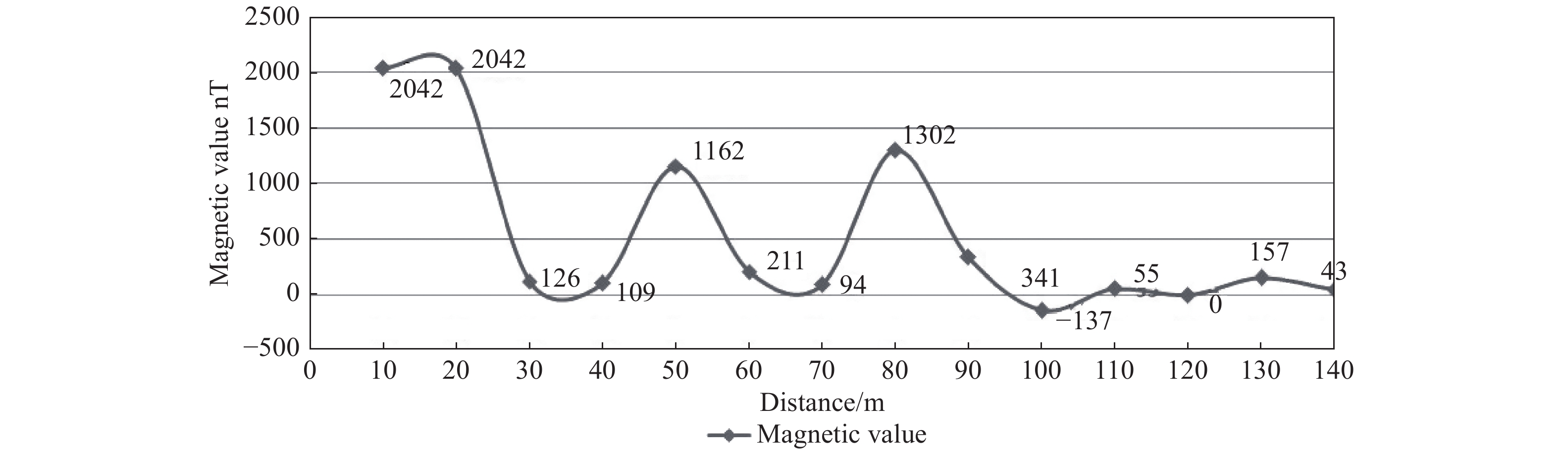
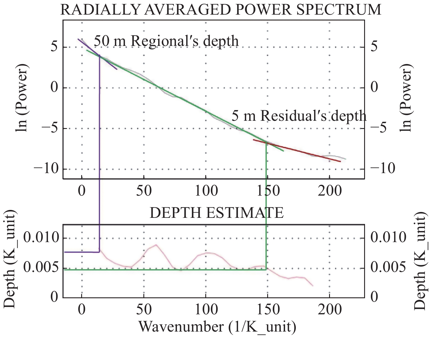
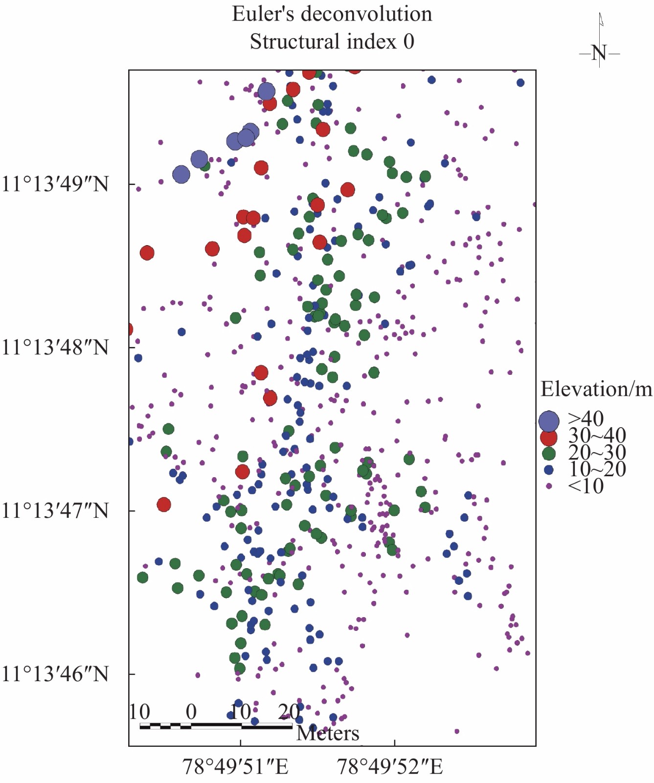
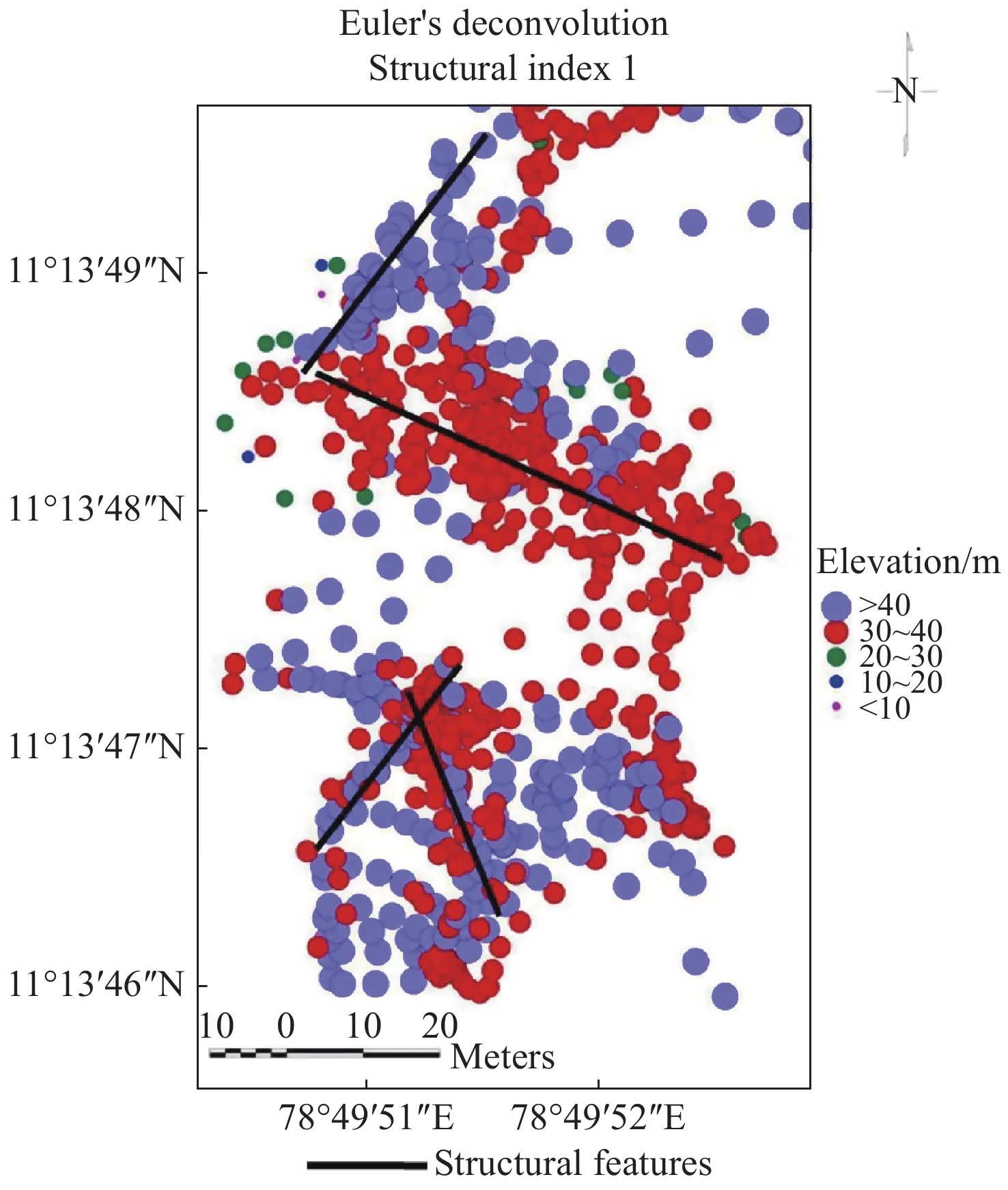
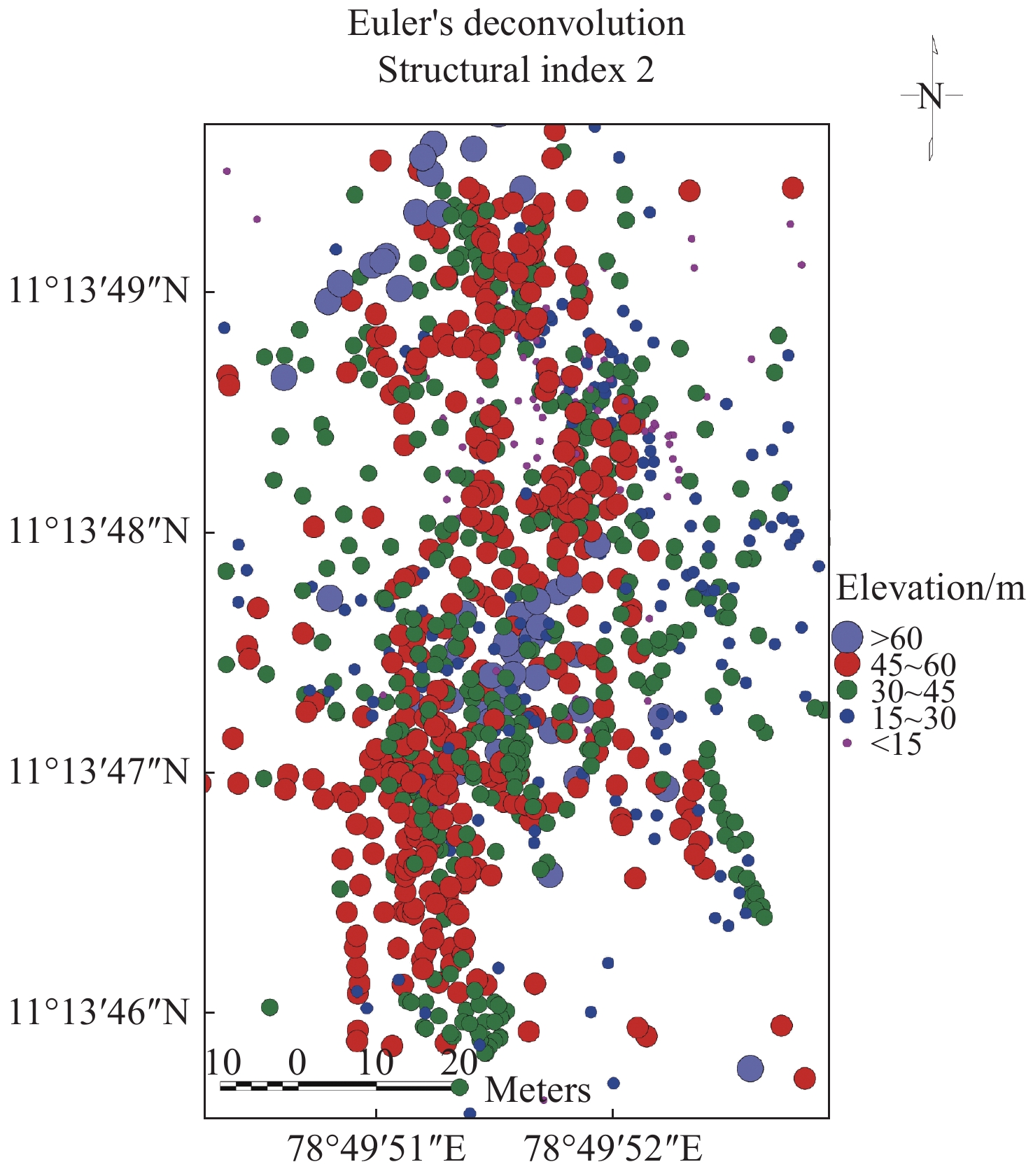
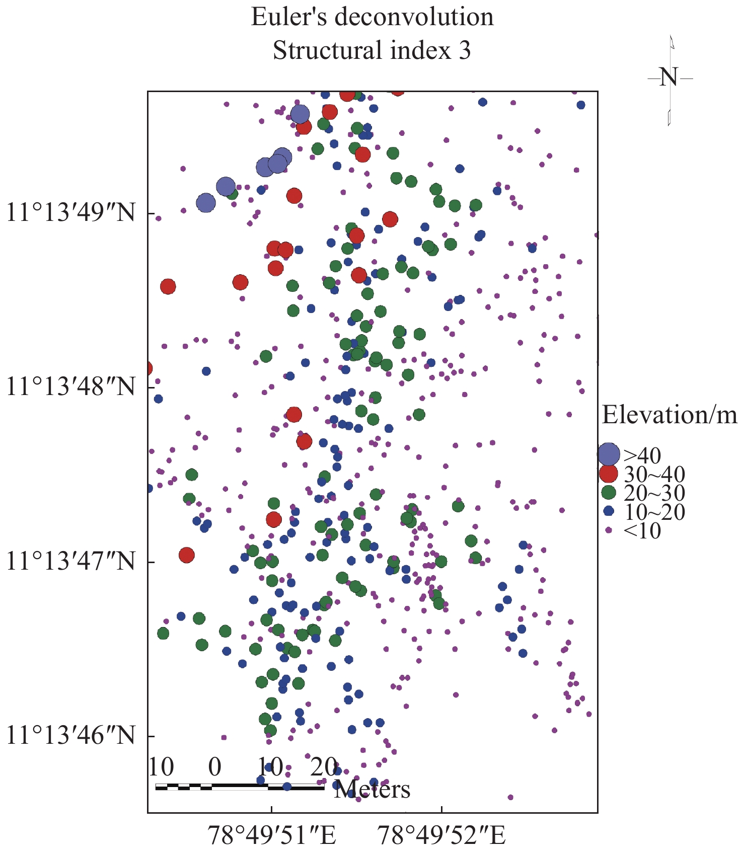
The study aims to identify a suitable site for open and bore well in a farmhouseusing ground magnetic survey in south India. It also aims to define depth to granitoid and structural elements which traverse the selected area. Magnetic data (n=84) measured, processed and interpreted as qualitative and quantitatively. The results of total magnetic intensities indicate that the area is composed of linear magnetic lows trending NE-SW direction and circular to semi-circular causative bodies. The magnetic values ranged from −137 nT to 2345 nT with a mean of 465 nT. Reduction to equator shows significant shifting of causative bodies in the southern and northern directions. Analytical signal map shows exact boundary of granitic bodies. Cosine directional filter has brought out structural element trending NE-SW direction. Results of individual profile brought to light structurally weak zone between 90 m and 100 m in all the profile lines. Sudden decrease of magnetic values from 2 042 nT to 126 nT noticed in profile line 6 between 20 m and 30 m indicates fault occurrence. Magnetic breaks obtained from these maps were visualized, interpreted and identified two suitable sites for open and bore well. Radially averaged power spectrum estimates depth of shallow and deep sources in 5 m and 50 m, respectively. Euler method has also been applied to estimate depth of granitoid and structural elements using structural indexes 0, 1, 2, and 3 and found depth ranges from <10 m to >90 m. Study indicates magnetic method is one of the geophysical methods suitable for groundwater exploration and site selection for open and borewells.
-
Keywords:
- Magnetic method /
- Groundwater exploration /
- Euler deconvolution /
- Open well
-

-
References
[1] Adagunodo TA, Sunmonu A, Adeniji A. 2015. An overview of magnetic method in mineral exploration. Journal of Global Ecology and Environment, 3(1): 13-28. [2] Daniel CU, Chimezie CO, SA Ugwu. 2018. Spectral analysis and euler deconvolution of regional aeromagnetic data to delineate sedimentary thickness in Mmaku Area, SouthEastern Nigeria. An international scientific journal, World Scientific News, 109: 26-42. [3] Dransfield MH, Buckingham MJ, van Kann FJ. 2018. Lithological Mapping by Correlating Magnetic and Gravity Gradient Airborne Measurements. Journal Exploration Geophysics, 25(1): 25-30. [4] Garcia JG, Ness GE. 1994. Inversion of the power spectrum from magnetic anomalies. Geophysics, 59: 391-400. doi: 10.1190/1.1443601 [5] Grant FS, Dodds J. 1972. MAGMAP FFT processing system development notes: Paterson, Grant and Watson Limited. [6] Hansen RO, Racic L, Grauch VJS. 2005. Magnetic methods in near-surface geophysics. In Near-Surface Geophysics. Society of Exploration Geophysicists Press: 151-175. [7] Muthamilselvan A, Srimadhi K, Nandhini R, et al. 2017. Spatial confirmation of major lineament and groundwater exploration using ground magnetic method near Mecheri Village, Salem District of Tamil Nadu, India. Journal of Geology & Geophysics, 6(1): 1-10. doi: 10.4172/2381-8719.1000274 [8] MacLeod IN, Jones K, Dai TF. 1993. 3-D analytic signal in the interpretation of total magnetic field data at low magnetic latitudes. Exploration Geophysics, 24(4): 679-688. [9] Nabighian MN. 1972. The analytic signal of two-dimensional magnetic bodies with polygonal cross-section: Its properties and use for automated anomaly interpretation. Geophysics, 37: 507-517. doi: 10.1190/1.1440276 [10] Nabighian MN, Grauch VJS, Hansen RO, et al. 2005. The historical development of the magnetic method in exploration. Geophysics, 70: 33-61. [11] Reid AB, Allsop JM, Granser H, et al. 1990. Magnetic interpretation in three dimensions using Euler Deconvolution. Geophysics, 55: 80-90. doi: 10.1190/1.1442774 [12] Serguel A Goussev, Jhon W Pierce. 2000. Gravity and magnetic exploration lexicon, acquisition, processing, interpretation and Imaging. Geophysical Exploration & Development Corporation: 1-157. [13] Spector A, Grant FS. 1970. Statistical models for interpreting aeromagnetic data. Geophysics, 35: 293-302. doi: 10.1190/1.1440092 [14] Sultan AA. 2015. Integrated geophysical interpretation on the groundwater aquifer (At the North Western Part of Sinai, Egypt). International Journal of Innovative Science, Engineering & Technology, 2(12): 501-522. [15] Tatiana FQ, Angelo S. 1998. Exploration of a lignite bearing in Northern Ireland, using Maurizio ground magnetic. Geophysics, 62(4): 1143-1150. [16] Thompson DT. 1982. EULDPH–a new technique for making computer-assisted depth estimates from magnetic data. Geophysics, 47: 31-37. doi: 10.1190/1.1441278 [17] Tsiboah T. 2002. 2D Resistivity and Time-Domain EM in aquifer mapping: A case study, north of Lake Naivasha, Kenya. Applied Geophysics, ITC. Netherlands: 110. [18] UNESCO. 1998. Unesco handbook for ground water investigations. Technical report, ITC. Netherlands. -
Access History
Figures(21)
Tables(4)

Export File
Citation
Muthamilselvan A. 2021. Identification of suitable sites for open and bore well using ground magnetic survey. Journal of Groundwater Science and Engineering, 9(3): 256-268. doi: 10.19637/j.cnki.2305-7068.2021.03.008
Format
Content
 DownLoad:


-
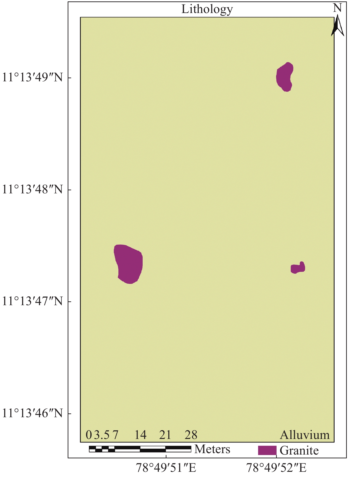
Figure 1.
Lithology of the study area
-
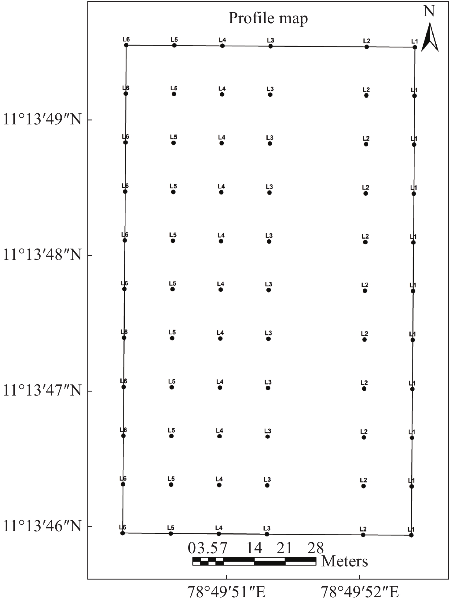
Figure 2.
Profile lines
-
Figure 3.
Magnetic contour
-
Figure 4.
Total magnetic intensity map
-
Figure 5.
Reduction to equator map
-
Figure 6.
Analytical signal map
-
Figure 7.
Cosine directional filter
-
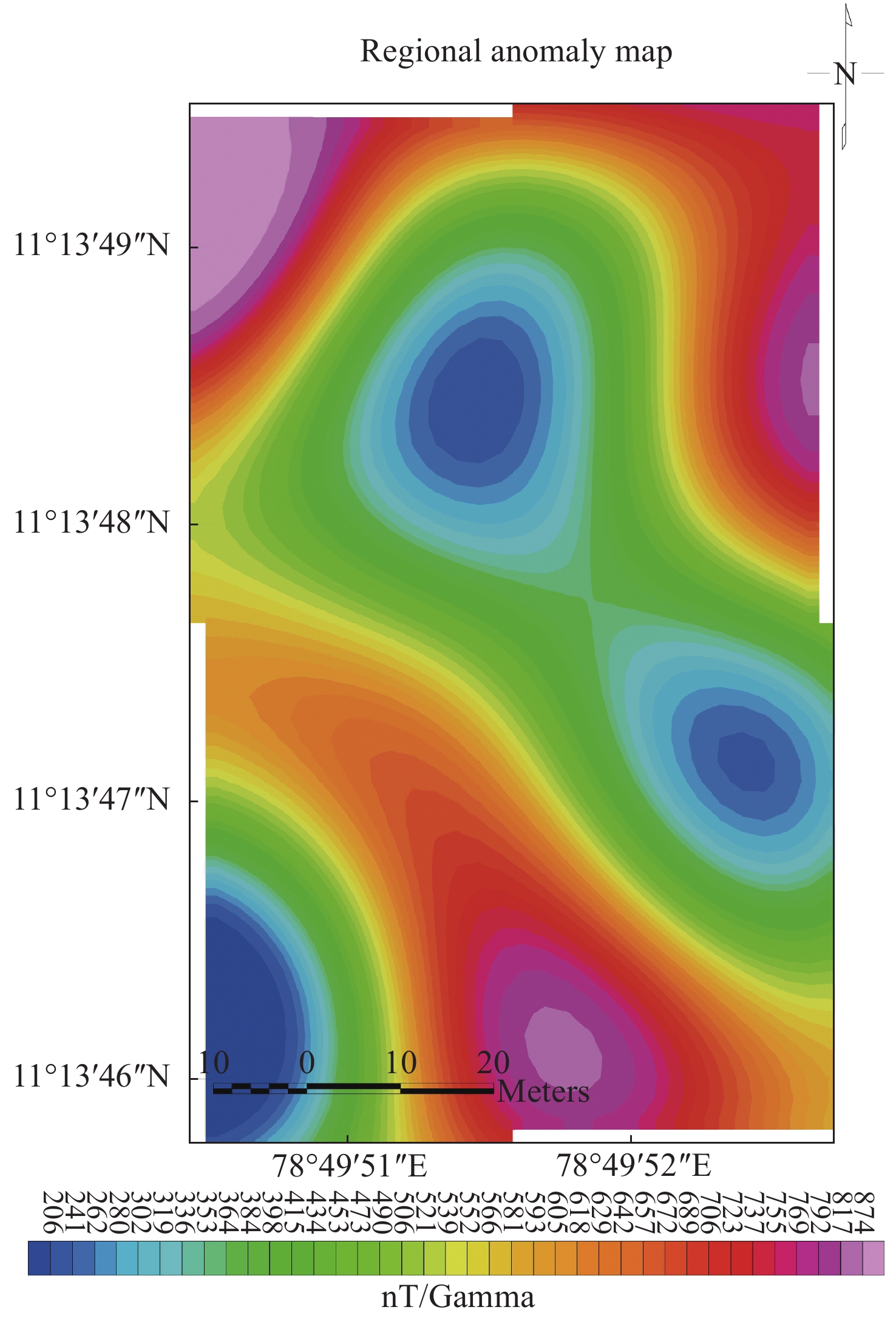
Figure 8.
Regional anomaly map
-
Figure 9.
Residual anomaly map
-
Figure 11.
Suitable sites for open and bore well
-
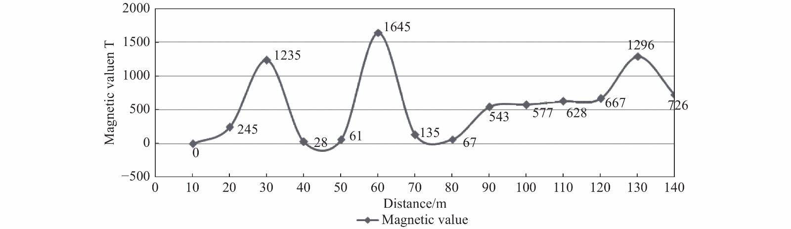
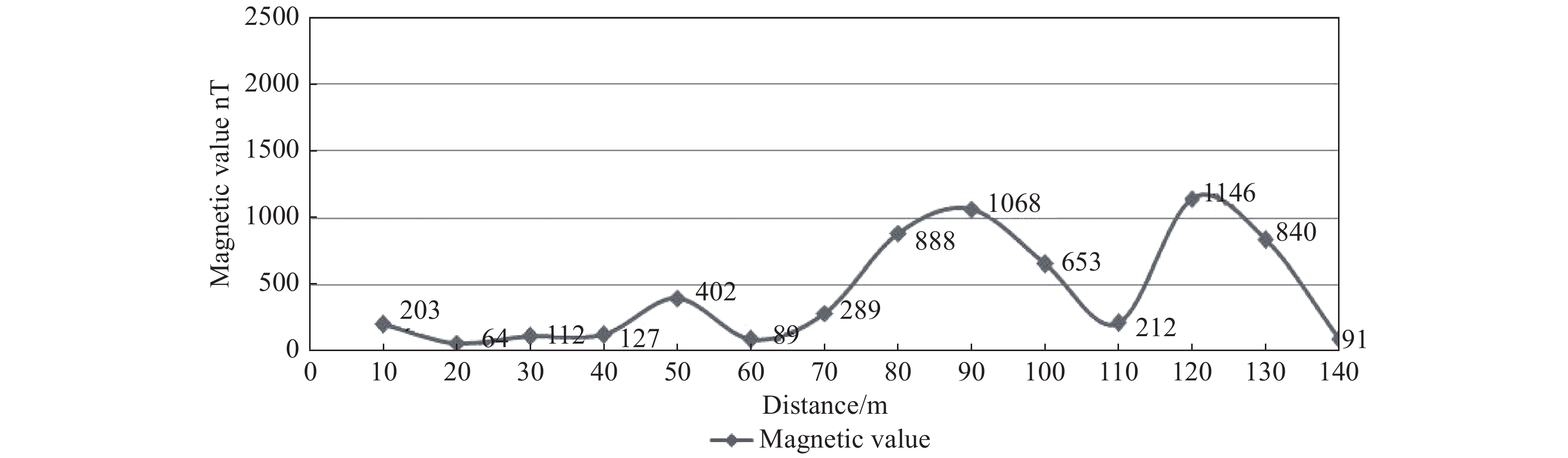
Figure 10a.
Magnetic profile line 1
-
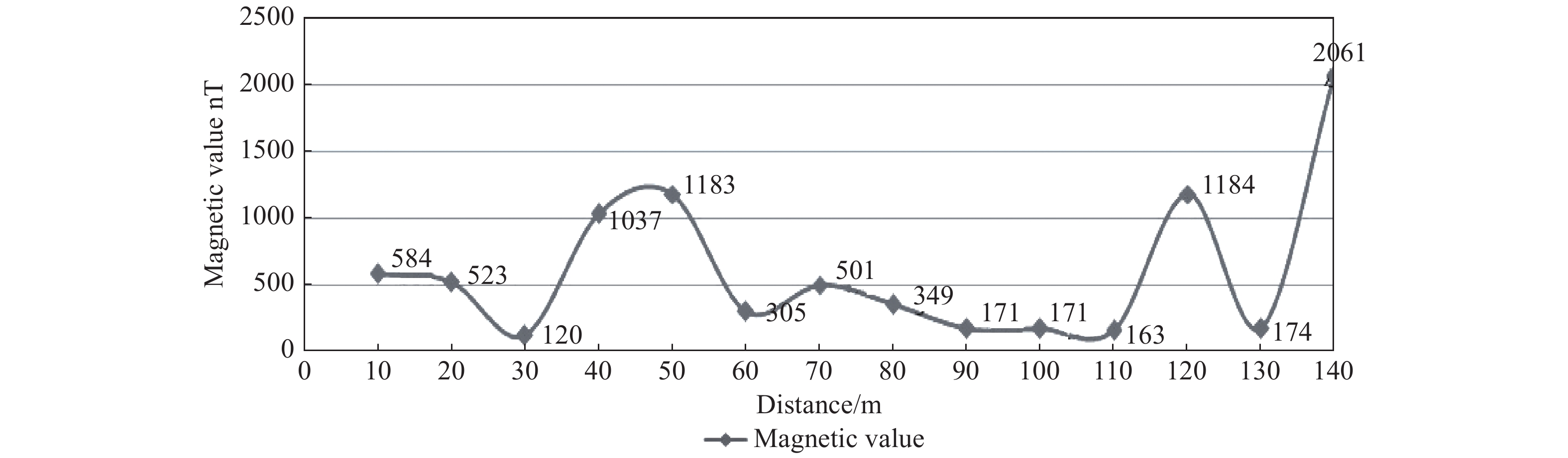
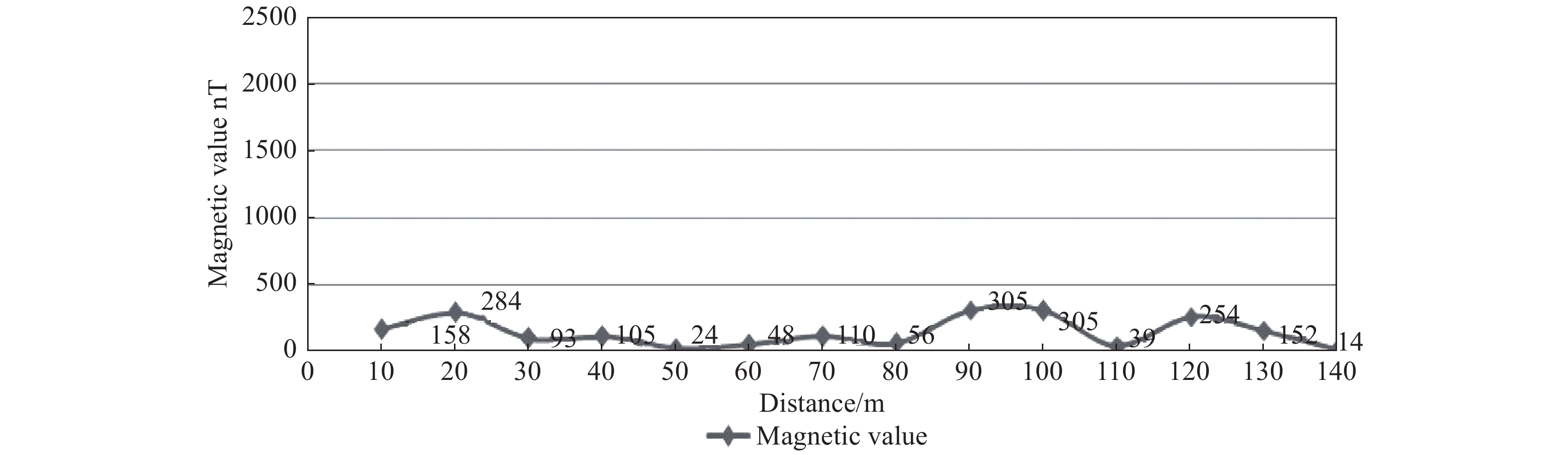
Figure 10b.
Magnetic Profile Line 2
-
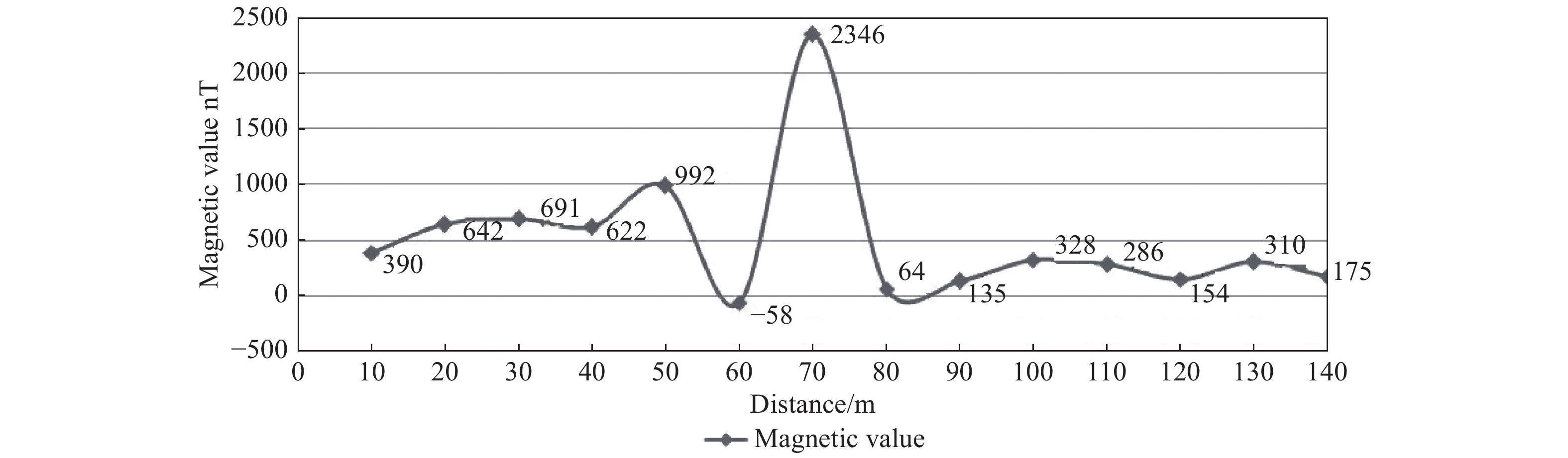
Figure 10c.
Magnetic profile line 3
-
Figure 10d.
Magnetic Profile Line 4
-
Figure 10e.
Magnetic profile line 5
-
Figure 10f.
Magnetic profile line 6
-
Figure 12.
Depth estimation using radially averaged power spectrum
-
Figure 13a.
Depth estimation using structural index 0
-
Figure 13b.
Depth estimation using structural index 1
-
Figure 13c.
Depth estimation using structural index 2
-
Figure 13d.
Depth estimation using structural index 3