

| Citation: |
CHU Hongliang, XING Gulian, LI Kunzhong, WANG Guoli, DUAN Qisan. Monitoring of dangerous rock mass in the Three Gorges Reservoir area based on the terrestrial laser scanning method[J]. Hydrogeology & Engineering Geology, 2021, 48(4): 124-132. doi: 10.16030/j.cnki.issn.1000-3665.202008015

|
Monitoring of dangerous rock mass in the Three Gorges Reservoir area based on the terrestrial laser scanning method
-
Abstract
Changes in water level of the Three Gorges Reservoir are easy to induce the deformation and failure of the reservoir slope. Periodic impoundment changes in the groundwater seepage field and stress field in the reservoir slope reduce the shear strength of rock and soil mass, and have a great impact on the stability of the reservoir bank slope and rock mass. It is urgent for the deformation monitoring of bank slopes in the reservoir area. It is difficult to find out the overall change of rock mass by setting fixed observation points, and the terrestrial laser scanning method (TLS) can obtain the point cloud data of the overall rock mass surface with centimeter accuracy, which is very suitable for the monitoring of rock mass of characteristics of no contact with the target, fast acquisition speed and high precision. In this paper, the terrestrial laser scanning method is used to monitor the dangerous rock mass of Jianchuandong in Wuxia county for two years (2017—2018) and three periods data are acquired. The stable rock mass data around the observation target of the first period is selected as datum and the iterative closest point registration (ICP) is carried out with the overlapping point cloud. The registration accuracy of the point cloud is better than ± 2.7 cm, which realizes the accurate alignment of multi-period data. According to the change of dangerous rock mass in the observation period, the datum TIN model of dangerous rock body area is constructed, and the deformation of dangerous rock mass is analyzed with the nearest distance method from point to reference surface combined with the change range of dangerous rock mass. Through the comparative analysis of the 3 periods observation data of the Jianchuandong dangerous rock mass, it is found that the dangerous rock mass has the expansion trend in 2018 compared with the left rock mass in 2017. In the reservoir water storage stage, there are obvious sag changes in some parts of the dangerous rock body, and the local deformation is about 30-70 mm due to the influence of water storage. The experiment proves the correctness and validity of the proposed monitoring method, which provides reference for the monitoring of dangerous rock state and the prevention and control of geological disasters in the Three Gorges Reservoir area.
-

-
References
[1] 王尚庆, 徐进军. 滑坡灾害短期临滑预报监测新途径研究[J]. 三峡大学学报(自然科学版),2006,28(5):385 − 388. [WANG Shangqing, XU Jinjun. New method to monitor and forecast landslide disaster in short-term[J]. Journal of China Three Gorges University (Natural Sciences),2006,28(5):385 − 388. (in Chinese with English abstract) [2] 徐进军, 王海城, 罗喻真, 等. 基于三维激光扫描的滑坡变形监测与数据处理[J]. 岩土力学,2010,31(7):2188 − 2191. [XU Jinjun, WANG Haicheng, LUO Yuzhen, et al. Deformation monitoring and data processing of landslide based on 3D laser scanning[J]. Rock and Soil Mechanics,2010,31(7):2188 − 2191. (in Chinese with English abstract) doi: 10.3969/j.issn.1000-7598.2010.07.027 [3] JABOYEDOFF M, OPPIKOFER T, ABELLÁN A, et al. Use of LIDAR in landslide investigations: a review[J]. Natural Hazards,2012,61(1):5 − 28. [4] 褚宏亮, 殷跃平, 曹峰, 等. 大型崩滑灾害变形三维激光扫描监测技术研究[J]. 水文地质工程地质,2015,42(3):128 − 134. [CHU Hongliang, YIN Yueping, CAO Feng, et al. Research on deformation monitoring of large collapses and landslides based on 3D laser scanning technology[J]. Hydrogeology & Engineering Geology,2015,42(3):128 − 134. (in Chinese with English abstract) [5] 刘明坤, 段奇三, 赵晨曦, 等. 三维激光扫描在滑坡灾害变形中的监测应用[J]. 测绘通报,2016(2):147 − 149. [LIU Mingkun, DUAN Qisan, ZHAO Chenxi, et al. Application of 3D laser scanning in monitoring landslide deformation[J]. Bulletin of Surveying and Mapping,2016(2):147 − 149. (in Chinese) [6] HOBBS P, HUMPHREYS B, REES J, et al. Monitoring the role of landslides in ‘soft cliff’ coastal recession[C]// International Conference on Instability, Planning & Management. Ventnor: Thomas Telford, 2002: 589−600. [7] 董秀军, 黄润秋. 三维激光扫描技术在高陡边坡地质调查中的应用[J]. 岩石力学与工程学报,2006,25(增刊2):3629 − 3635. [DONG Xiujun, HUANG Runqiu. Application of 3D laser scanning technology to geologic survey of high and steep slope[J]. Chinese Journal of Rock Mechanics and Engineering,2006,25(Sup2):3629 − 3635. (in Chinese with English abstract) [8] ABELLÁN A, VILAPLANA J M, CALVET J, et al. Rockfall monitoring by terrestrial laser scanning-case study of the basaltic rock face at Castellfollit de la Roca(Catalonia, Spain)[J]. Natural Hazards and Earth System Sciences,2011,11(3):829 − 841. doi: 10.5194/nhess-11-829-2011 [9] 谢谟文, 胡嫚, 杜岩, 等. TLS技术及其在滑坡监测中的应用进展[J]. 国土资源遥感,2014,26(3):8 − 15. [XIE Mowen, HU Man, DU Yan, et al. Application of TLS technique to landslide monitoring: Summarization and prospect[J]. Remote Sensing for Land & Resources,2014,26(3):8 − 15. (in Chinese with English abstract) [10] 裴东东, 官云兰, 张勇峰, 等. 基于车载三维激光扫描系统的滑坡变形监测方法[J]. 中国地质灾害与防治学报,2016,27(1):71 − 76. [PEI Dongdong, GUAN Yunlan, ZHANG Yongfeng, et al. Landslide deformation monitoring method based on vehicular laser scanning system[J]. The Chinese Journal of Geological Hazard and Control,2016,27(1):71 − 76. (in Chinese with English abstract) [11] 王文沛, 李滨, 黄波林, 等. 三峡库区近水平厚层斜坡滑动稳定性研究—以重庆巫山箭穿洞危岩为例[J]. 地质力学学报,2016,22(3):725 − 731. [WANG Wenpei, LI Bin, HUANG Bolin, et al. Stability analysis of sub-horizontal thick-bedded slope in Three Gorges Reservoir Area: A Case study of Jianchuandong dangerous rock mass in Wushan, Chongqing[J]. Journal of Geomechanics,2016,22(3):725 − 731. (in Chinese with English abstract) doi: 10.3969/j.issn.1006-6616.2016.03.026 [12] WANG G, PHILIPS D, JOYCE J, et al. The integration of TLS and continuous GPS to study landslide deformation: A case study in Puerto Rico[J]. Journal of Geodetic Science,2011,1(1):25 − 34. [13] 朱海雄, 隋立春, 鲁凯翔. 三维激光扫描技术在危岩体变形监测中的应用[J]. 测绘通报,2017(11):68 − 71. [ZHU Haixiong, SUI Lichun, LU Kaixiang. Application of terrestrial 3D laser scanning technology in deformation monitoring of dangerous rock mass[J]. Bulletin of Surveying and Mapping,2017(11):68 − 71. (in Chinese with English abstract) [14] 方良斌, 张宏魏, 詹建勇, 等. 基于移动平均法的危岩点云数据处理及变形分析[J]. 人民长江,2019,50(4):152 − 156. [FANG Liangbin, ZHANG Hongwei, ZHAN Jianyong, et al. Point cloud data processing of dangerous rock and deformation analysis based on moving average method[J]. Yangtze River,2019,50(4):152 − 156. (in Chinese with English abstract) [15] 徐寿志, 程鹏飞, 张玉, 等. 地面三维激光扫描仪的检校与测量精度评定[J]. 测绘通报,2016(2):79 − 83. [XU Shouzhi, CHENG Pengfei, ZHANG Yu, et al. Calibration and accuracy evaluation of terrestrial laser scanner[J]. Bulletin of Surveying and Mapping,2016(2):79 − 83. (in Chinese) [16] MAT ZAM P M, FUAD N A, YUSOFF A R, et al. Evaluating the performance of terrestrial laser scanning for landslide monitoring[C]//Int Arch Photogramm Remote Sens Spatial Inf Sci, 2018: 35-55. [17] OPPIKOFER T, JABOYEDOFF M, BLIKRA L, et al. Characterization and monitoring of the Aknes rockslide using terrestrial laser scanning[J]. Natural Hazards and Earth System Sciences,2009(9):1003 − 1019. [18] ABELLÁN A, JABOYEDOFF M, OPPIKOFER T, et al. Detection of precursory deformation using a TLS application to spatial prediction of rockfalls[J]. Natural Hazards and Earth System Sciences,2009(9):365 − 372. -
Access History
Figures(16)
Tables(2)

Export File
Citation
CHU Hongliang, XING Gulian, LI Kunzhong, WANG Guoli, DUAN Qisan. Monitoring of dangerous rock mass in the Three Gorges Reservoir area based on the terrestrial laser scanning method[J]. Hydrogeology & Engineering Geology, 2021, 48(4): 124-132. doi: 10.16030/j.cnki.issn.1000-3665.202008015
Format
Content
 DownLoad:


-
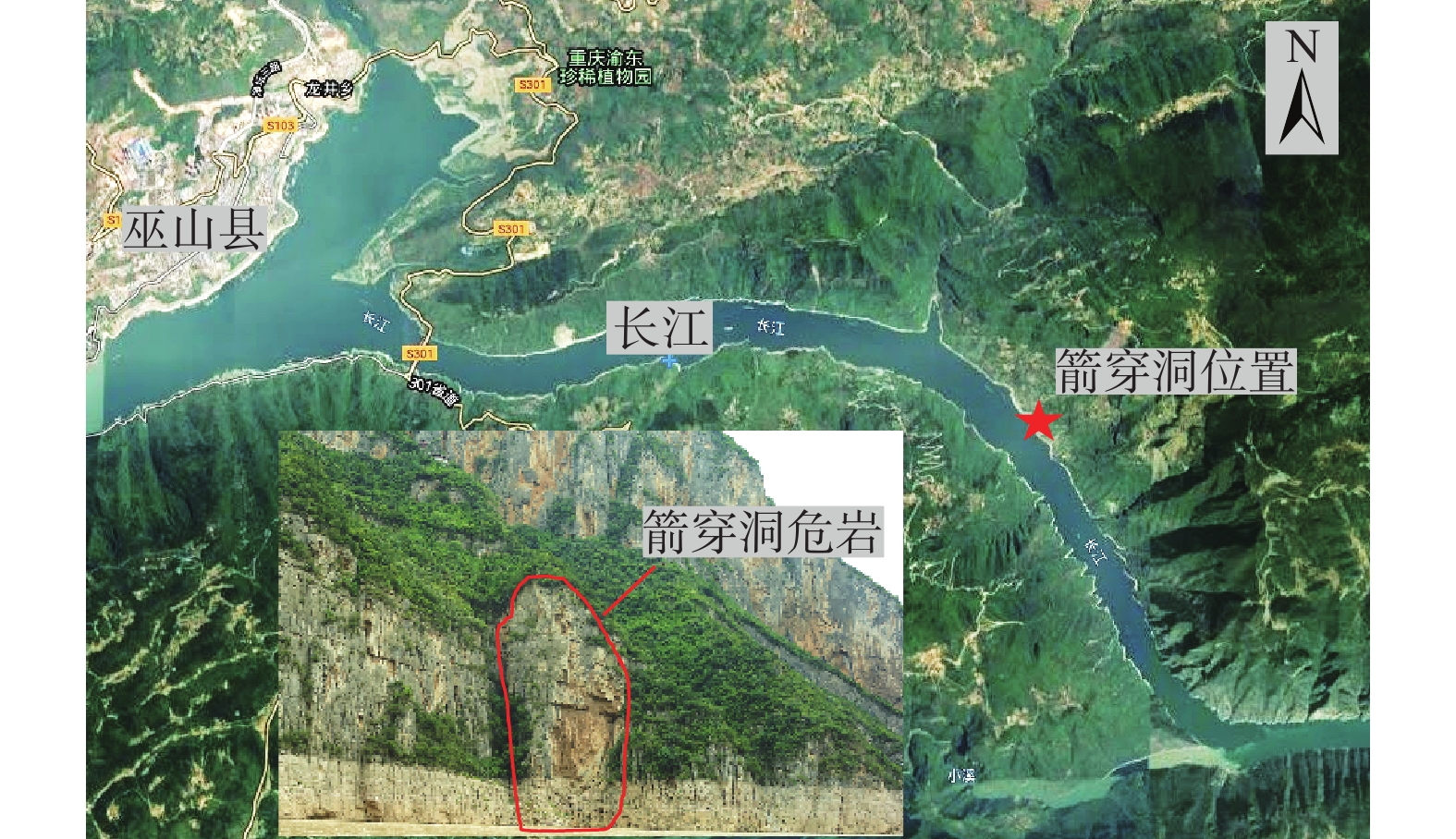
Figure 1.
Location of Jianchuandong and dangerous rock mass
-
Figure 2.
Setting of the monitoring datum
-
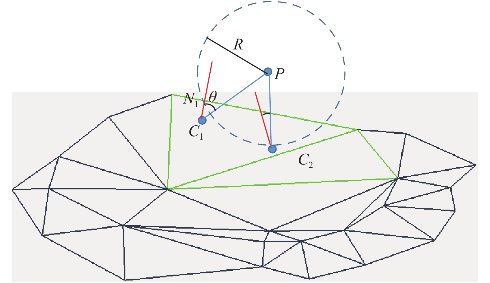
Figure 3.
Analysis of laser point cloud changes of dangerous rock mass with the point-face method
-
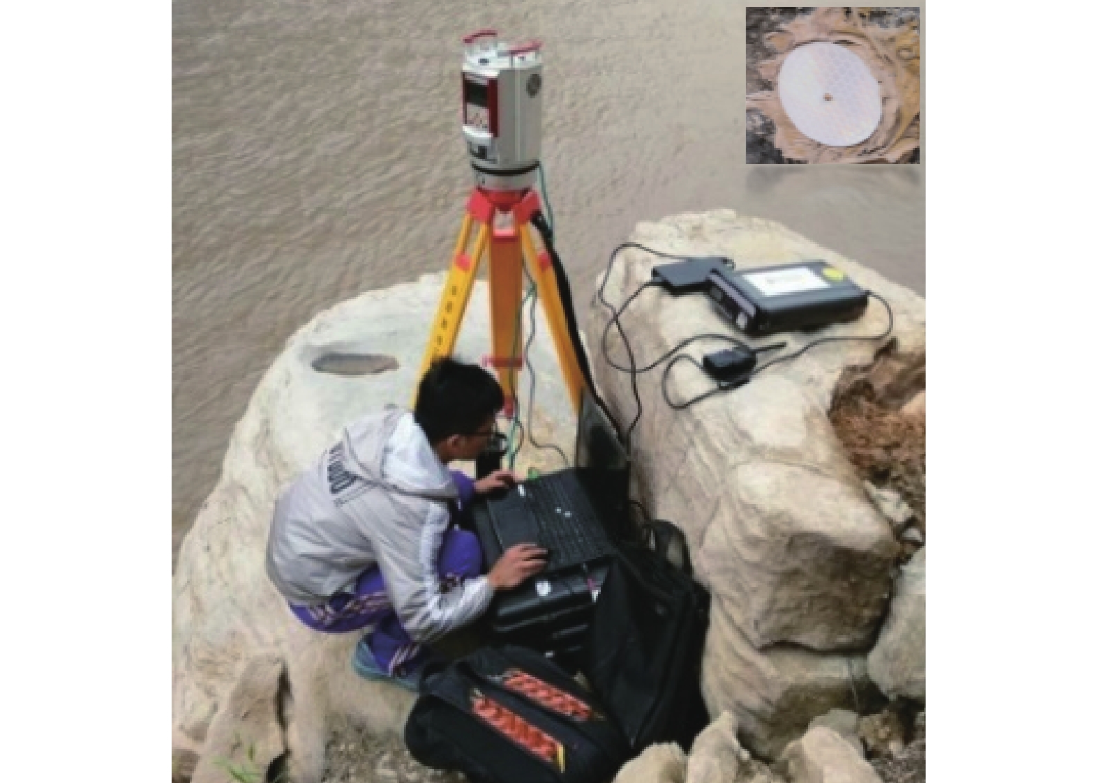
Figure 4.
Jianchuandong scanning station and reflector
-
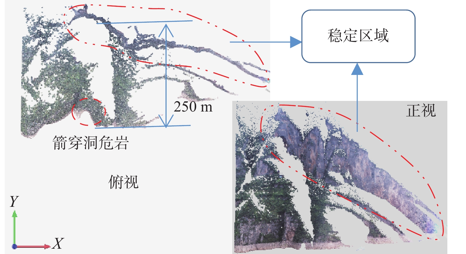
Figure 5.
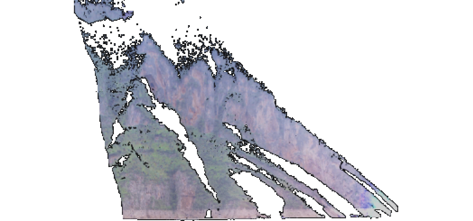
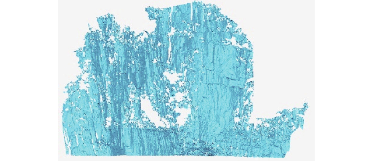
Point cloud of Jianchuandong
-
Figure 6.
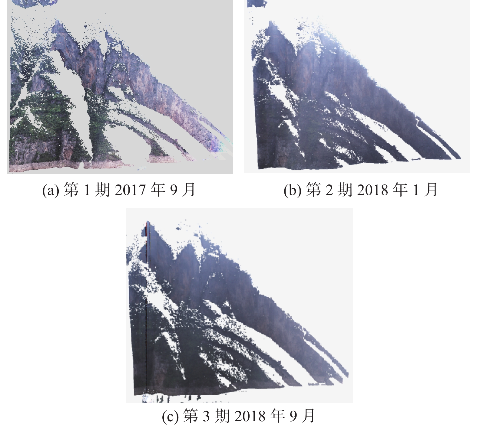
Three periods point cloud of Jianchuandong (average point distance of 0.08 m)
-
Figure 7.
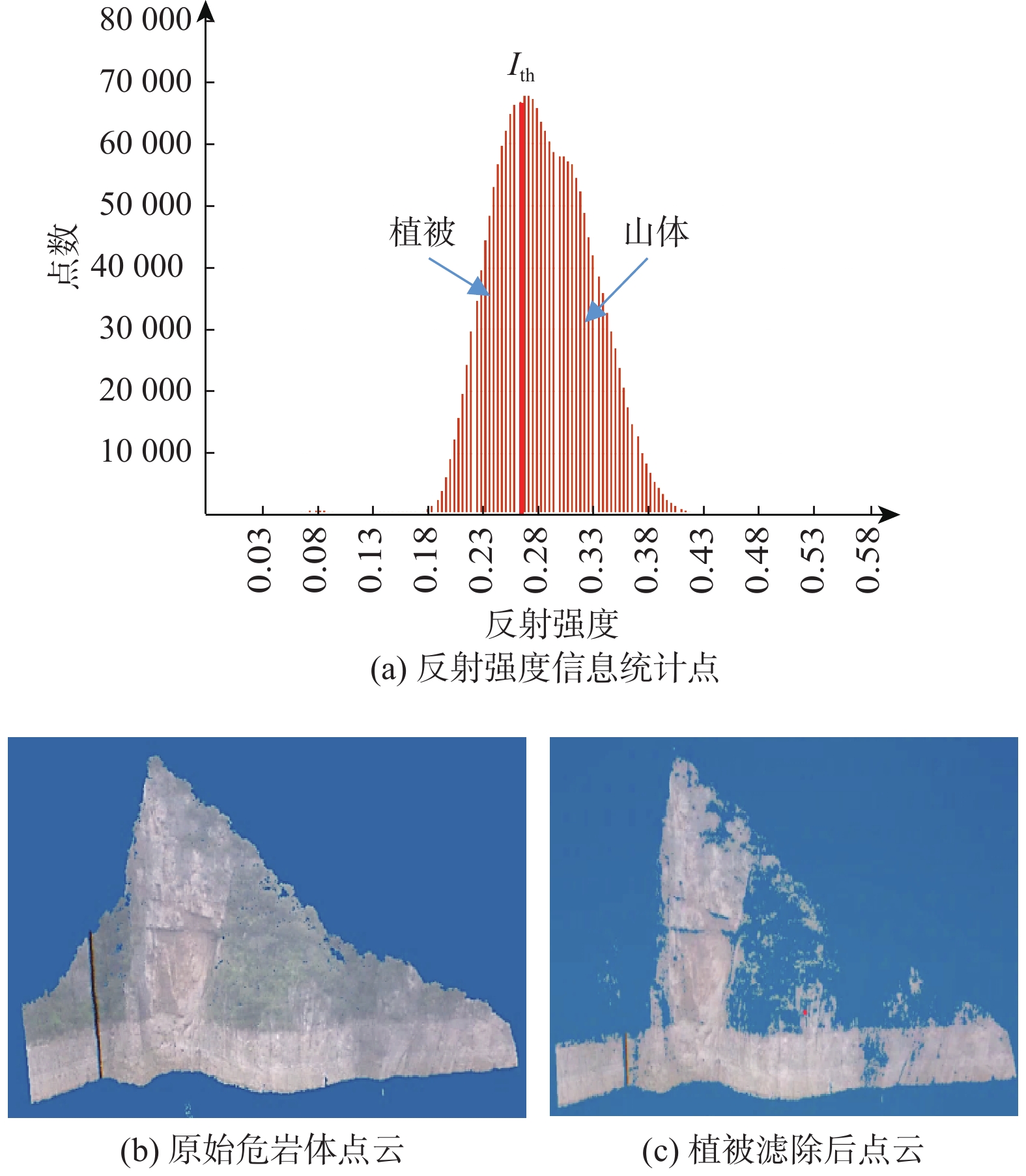
Filtering of vegetation point cloud (Ith = 0.29, test point cloud is 2.02 million, vegetation point is 0.93 million)
-
Figure 8.
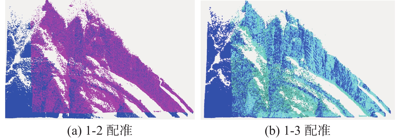
Registration reference and error distribution of point cloud data (Calculation region of ± 0.1m. Registration 1-2 with average deviation of 0.063 m, standard deviation of ± 0.024 m. Registration 1-3 with average deviation of 0.036 m, and standard deviation of ± 0.028 m)
-
Figure 9.
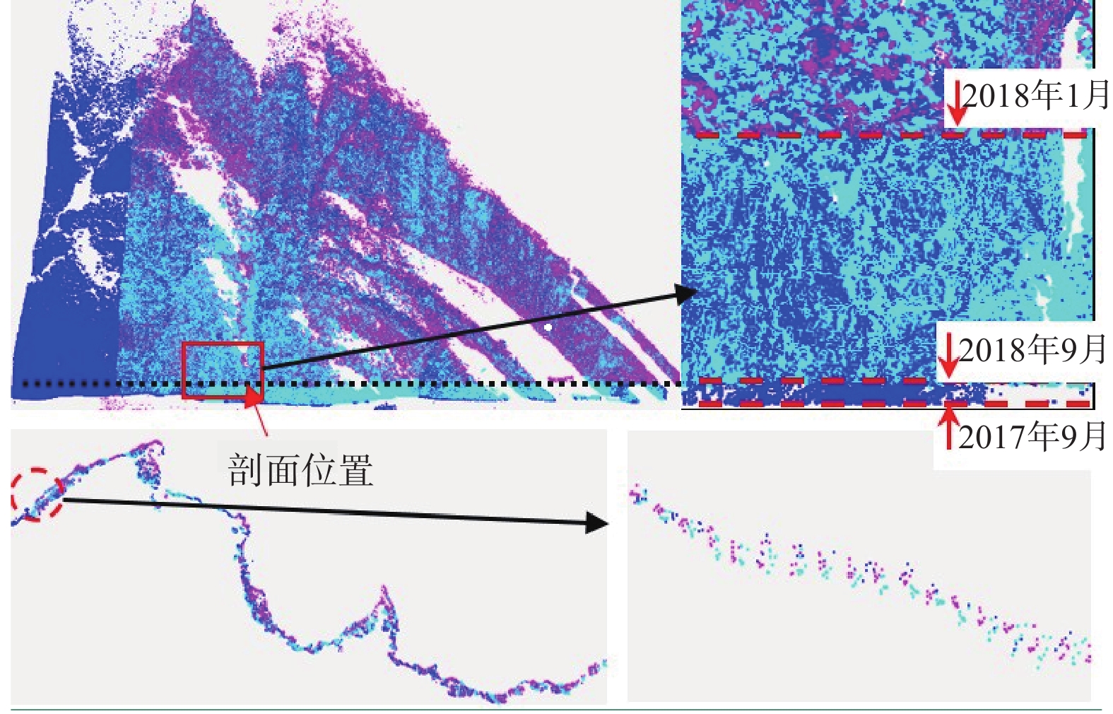
Overlay analysis for 3 periods of point cloud
-
Figure 10.
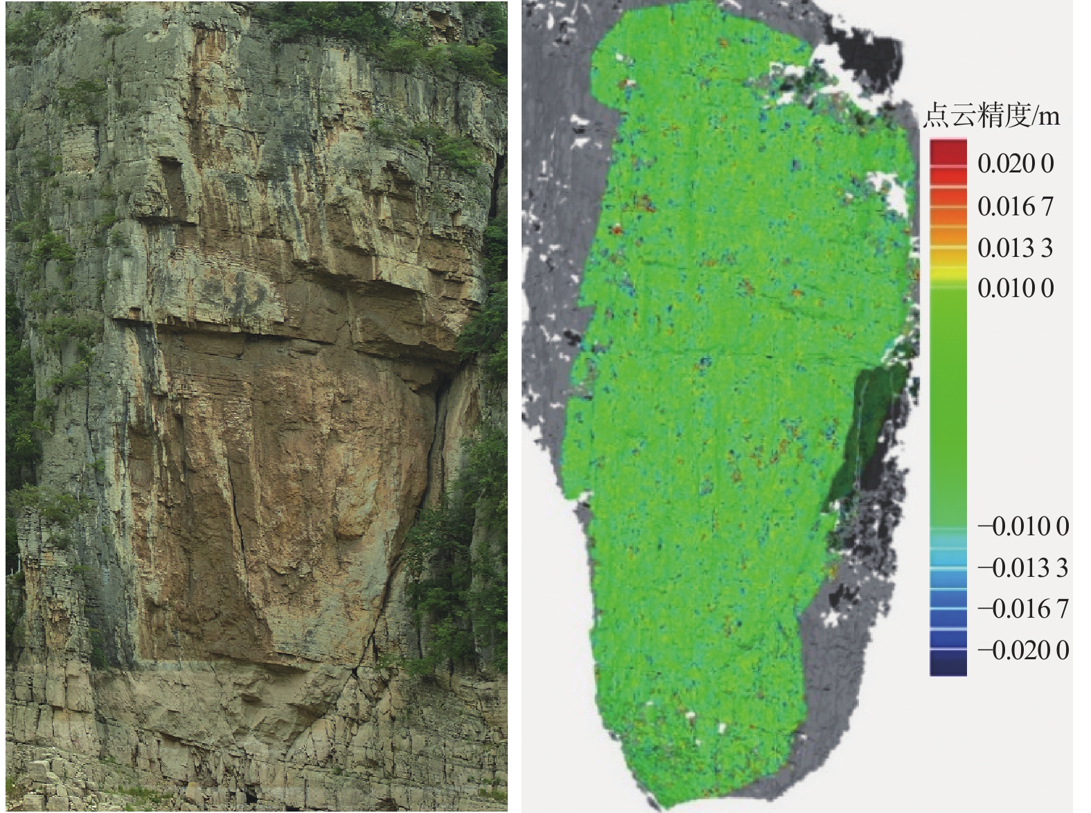
Accuracy analysis of point cloud
-
Figure 11.
Reference TIN model of dangerous rock mass of Jianchuandong (Period 1,step of TIN model of 80 mm, 1.8 million pieces in total)
-
Figure 12.
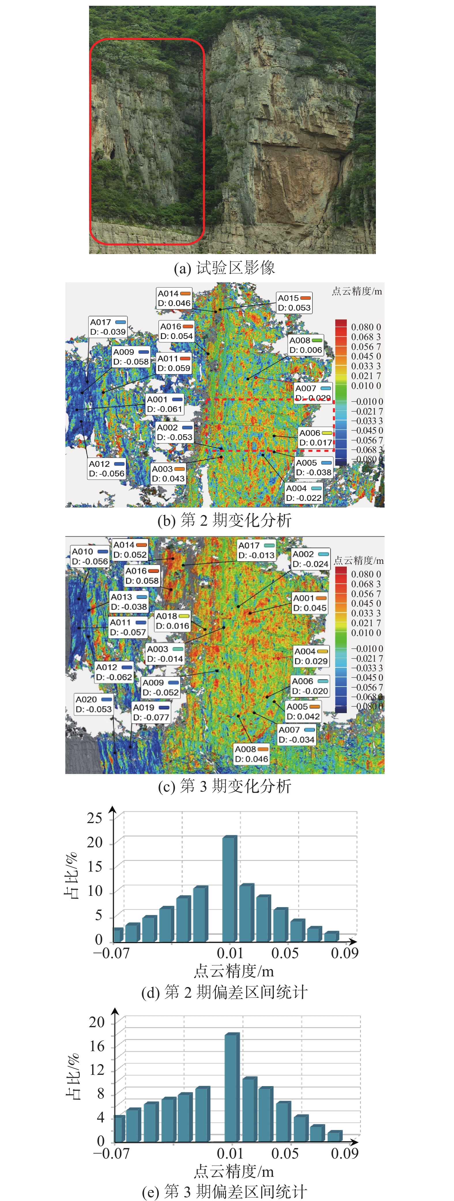
Change analysis and statistics of dangerous rock mass
-
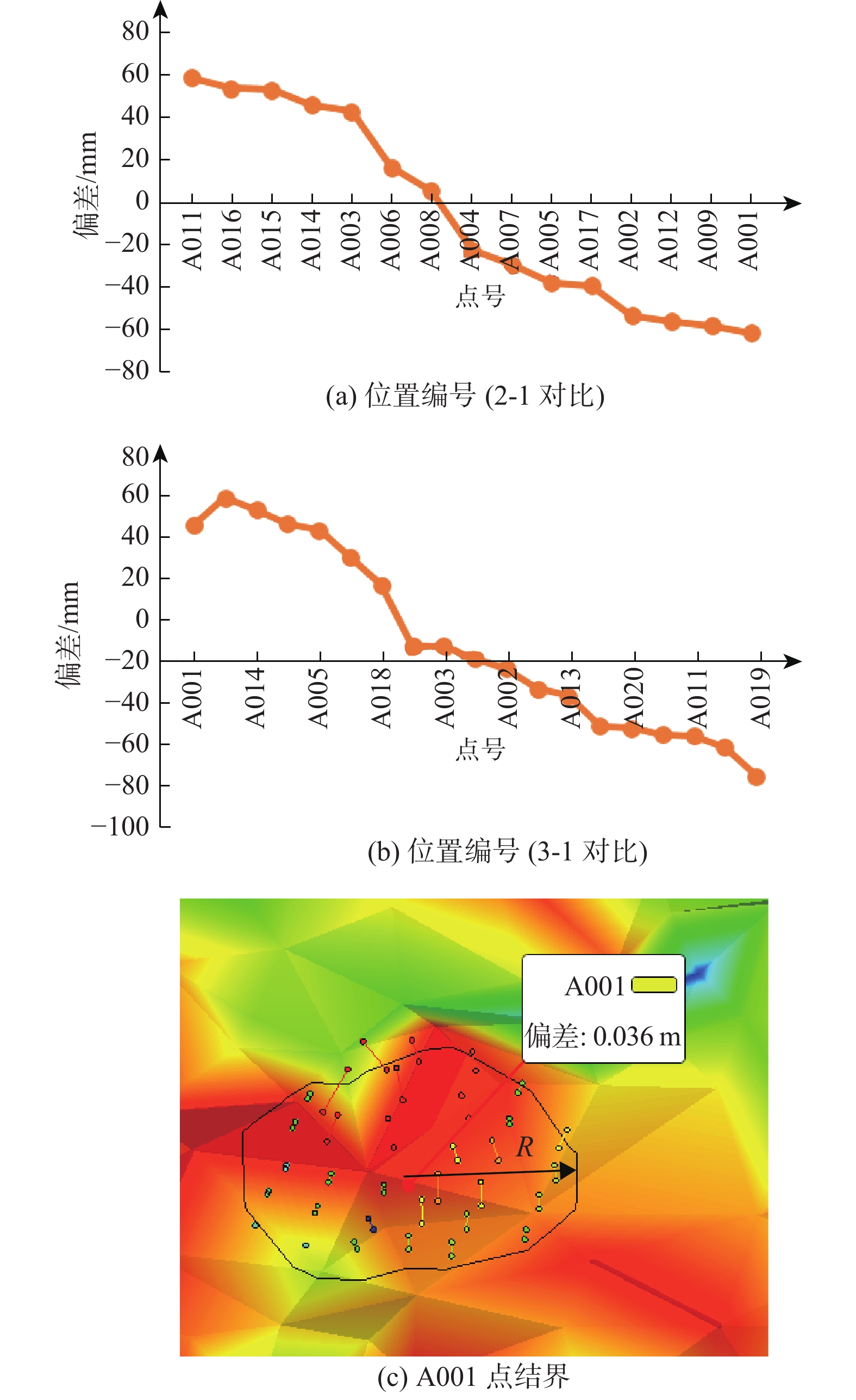
Figure 13.
Measurements of typical values of dangerous rock change (R= 0.3 m)
-
Figure 14.
Local area change analysis (analysis interval of ±0.08 m)
-
Figure 15.
Compression statistical interval results of dangerous rock mass change
-
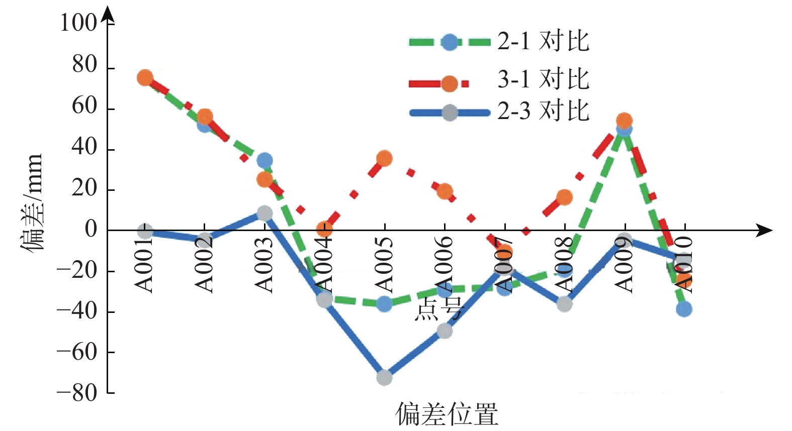
Figure 16.
Analysis of local typical position changes of dangerous rock mass